November is a beautiful month when grape leaves turn red in autumn. The Katsunuma New Wine Festival is held every year on November 3rd at 'Budo-no-Oka' in Katsunuma Town, Koshu City. The Katsunuma New Wine Festival celebrates the year's harvest. Wineries in Koshu City bring their freshly brewed wines to the event, allowing you to taste new wine earlier than anywhere else.
Ms. Mariko Hayashi: Grapes Get in My Eyes (KADOKAWA, 1986). The story is set in a provincial city in the early 1970s, in a preparatory school that was converted from an old middle school into a coeducational school after the war. The protagonist is a high school girl (the author's alter ego) who has a complex about her appearance, is self-conscious, and is not cool.
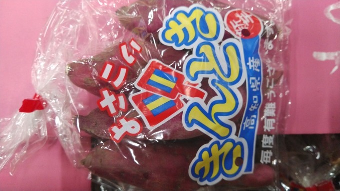
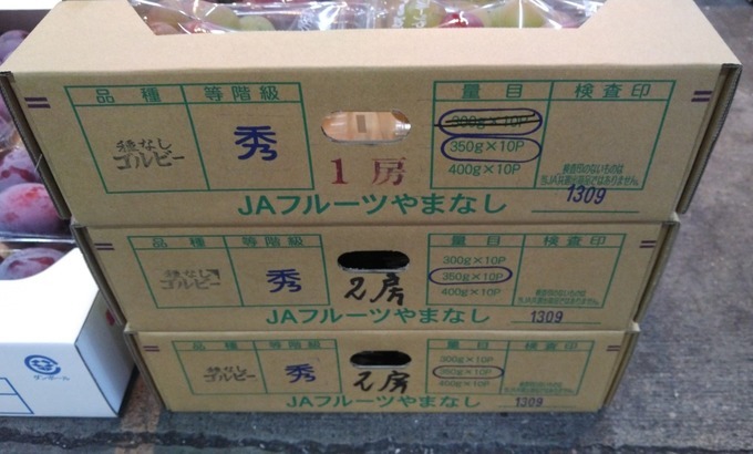
【Product name】
Seedless Gorby
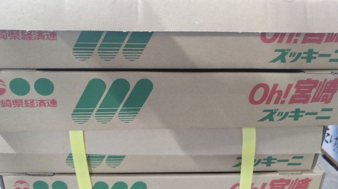
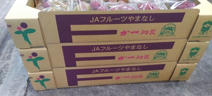
On May 30, 2022, the highest temperatures in Katsunuma and Kofu in Koshu City, Yamanashi Prefecture, were the highest and second in the country, and it seems that the heat was approaching the hottest day. Katsunuma, Koshu City is No. 1 in Japan at 34.1 degrees Celsius, and Kofu is 33 degrees Celsius, share second place with Kamisatomi Town, Takasaki City, Gunma Prefecture. Katsunuma has the highest temperature of 34.1 degrees Celsius, which is the highest in Japan, and Koshu is 33 degrees Celsius, which is the second highest in Japan. Most of the causes of the recent situation and abnormal weather are meteorological disturbances such as westerly meandering and typhoons, and El Nino (the sea surface temperature from off Peru to the vicinity of the date change line continues to be higher than normal for one to one and a half years. It seems that it has been regarded as an internal change in the atmosphere such as (phenomenon) and interaction with the ocean. However, recently, it seems that the rainfall pattern has fluctuated due to the rise in the average temperature of the earth due to the increase in the concentration of greenhouse gases in the atmosphere, and the frequency of abnormal weather has increased. In addition, abnormal weather is an important factor that has a great impact not only on food but also on housing. If it rains for a long time, houses near the river are more likely to be flooded under the floor or above the floor due to flooding of the river, and in the worst case, the entire house is washed away, which may lead to an emergency. When the amount of precipitation increases and the precipitation time becomes long, rainwater permeates deep into the ground, and the sediment on the surface flows out, and it is customary that a large sediment disaster such as a deep landslide that causes the entire mountain to collapse together with the rock that supports the ground is likely to occur. From 2011 to 2015, the Japan Meteorological Agency, which is an external agency of the Ministry of Land, Infrastructure, Transport and Tourism, conducted joint research with the National Agriculture and Food Research Organization (NARO) to conduct research on risk management using weather forecast information. gone. Research has been conducted not only on the "hot days" and "typhoons and torrential rains" that have been the focus of attention, but also on "cold damage", and as a result, it seems that some methods have been created to reduce the deterioration of crop quality. According to the Ministry of Agriculture, Forestry and Fisheries "2008 Global Warming Impact Survey Report" (September 2009), etc., at production sites in Japan, the impact on agricultural products that is thought to be due to global warming such as high temperature damage is nationwide. It has occurred. For example, it has been reported that ripening disorders occur in paddy rice, poor coloring / delayed coloring in apples, mandarins, grapes, etc., frequent occurrence of pests, poor growth in leaf stem vegetables, and decreased milk yield / components in dairy cows. It seems. In addition, according to the prediction of changes in the yield of paddy rice by the global climate model, it seems that the influence of climate change will increase from 2081 to 2100, and the yield will increase in northern Japan, while it will decrease in China and Kyushu. Furthermore, it is predicted that the suitable land for cultivation of crops will move due to global warming. For this reason, measures are being considered to predict global warming and to avoid the effects of climate change on agriculture as much as possible. So far, for example, adaptation measures such as changing the transplantation period to avoid high temperatures during the ripening period for paddy rice, and coloring improvement technology by cyclic peel treatment for grapes have been developed. Fruit trees) have not been washed away or released overseas, and the tragedy of the workers is miserable. At each prefecture stage, development of new varieties of paddy rice that can avoid quality deterioration due to high temperature, development and introduction of apple varieties that can be colored even at high temperature, change of cropping season by low-stage dense planting of tomato, tropical and subtropical It seems that efforts such as branding by introducing crops are being promoted. 5093 Hishiyama, Katsunuma Town, Koshu City: “Katsunuma Vineyard” is a tourist facility operated by the city, which stands on a small hill in the vineyard that spreads out at the eastern end of the Kofu Basin. In the underground wine cave, there are always 150 to 200 brands of wine that have passed the quality examination committee sponsored by the city. Also, if you buy a special container (Tart Van), you can sample each brand. At the hot spring facility “Tenku no Hot Water”, you can enjoy high-quality hot springs while watching the scenery of the Kofu basin below. It is said that the wine restaurant prepares dishes that match the wine produced in Koshu City. In addition, there are barbecue facilities, a light meal lounge in the sky, and an adjacent museum. The accommodation facility is said to have hot springs in all rooms. It was decided on July 19, 2019 that six buildings that tell the history of winemaking will be added to the national registered tangible cultural properties. The National Council for Cultural Affairs reported to the Minister of Education, Culture, Sports, Science and Technology at the main building and storage of the winery built from the Meiji era to the postwar period. For details, there are 6 cases: Marufuji Winery's old brewery and bottle storage, Katsunuma brewing's main house and office and barrel storage, Kuramubon wine's old main house and wine cellar. According to the City Board of Education, there are four Japanese-style wineries with main houses and stores in Katsunuma Town, where winemaking began in the Meiji era. Together with Haramo Wine, which was registered last year, the buildings of all four companies have become registered tangible cultural properties. It is customary for Yamanashi grapes and wine to originate from the Koshu variety. Before the Edo period, it seems that only this Koshu species was cultivated in Japan. In particular, the climate of Yamanashi Prefecture, which is rich in seasonal changes, is a soil and meteorological environment suitable for viticulture. Among them, as the optimum cultivation area for the Koshu species, which is the only native species in Japan, mainly in the Katsunuma area, it has extremely natural conditions, and it produces finer, more mellow and beautiful fruits. Wine is a combination of climate and people's hearts. The Koshu species belongs to the oriental group (Proles orientalis) of European descent (Vitis vinifera), but its origin is Gyoki (a monk of the Hosso sect of the Nara period. Born in Otori District (currently Osaka Prefecture). Learned from Michiaki, a high priest of the Hosso sect, and worked on private missions especially for farmers. There are many temples such as Daizenji Temple, Unpouji Temple, and Hojoji Temple that are said to have opened Gyoki.) Introduction theory and the resident of Mr. Kageyu Amemiya Residents of the village (currently Katsunuma Town). In 1186, on the way back from the “Shironohira” festival, he discovered a wild vine and moved it to his own field to cultivate it. This is said to be the origin. Koshu grapes were presented to Kageyu on the way back to Zenkoji Temple.) There is a legend, and it is alive as a story unique to Katsunuma, but in any case, it has a long history of 1280 to 810 years based on both theories (Recently, as a result of DNA analysis, the Koshu variety is a European variety. It has been suggested that there is no contradiction in the theory that it inherited the genetic traits of the above and passed from Europe to China and Japan via the Silk Road). It can be inferred that the creativity of the shelves and the spread of their technology were epoch-making in the history of cultivation of Koshu species. In Japan, where the trees are vigorous and it rains a lot, it seems that the stock tailoring and hedge tailoring were not good. Taking advantage of this characteristic, Tokuhon Nagata, a Chinese medicine doctor (a doctor from the Muromachi period to the Edo period. He was also called “Tokuhon of Kai” because he lived in Kai Province for a long time. He first served Nobutora Takeda as a doctor, and later Shinano. After the destruction of the Mr. Takeda family, he returned to Kai. During the Genna period, he devised a method for shelving grapes in Kamiiwasaki Village (currently Katsunuma Town) and contributed to the development of grape cultivation. , It is said that Hidetada Tokugawa's illness was cured. However, there are many unclear points about the end of the Warring States period and the beginning of the Edo period.) Is said to have devised a method of making a shelf with bamboo and taught it to the villagers of Katsunuma. Viticulture on bamboo shelves continued until the early Meiji era, and in 1879, Sakuzaemon Amemiya of Kamiiwasaki came up with the idea of replacing bamboo with a thin iron bar. Furthermore, in 1908, Katsunuma Postmaster Kangoro Wakao built an iron wire shelf with the hint of the telegraph line arrangement, and established the foundation of the iron wire shelf that can withstand the heavy pressure by stretching the current branch line and branch line. On July 1, 1889, due to the enforcement of the town and village system, Katsunuma Village since the early modern period formed an independent municipality. On March 2, 1896, Katsunuma Village enforced the town system and became Katsunuma Town. On May 10, 1942, Katsunuma Town was established again by merging with Todoroki Village. On April 5, 1954, Katsunuma Town was established again by merging with Hishiyama Village, Shinonome Village, and Iwai Village, Higashiyatsushiro County. On November 1, 2005, Koshu City was established by merging with Enzan City and Yamato Village, and Katsunuma Town was abolished on the same day. “Koshu City, Yamanashi Prefecture”,(Concerning municipalities which changed characters for names and adopted old provincial names virtually, there are Mutsu City, Iwaki City, Sanuki City, Oushu City, and Koshu City.)になる. Located on the east side of the Kofu Basin, Mt. Fuji, Southern Alps(The South Alps cover an area of over 300,000 ha across Yamanashi, Nagano and Shizuoka Prefectures.), Yatsugatake (Yato Castle Ruins: Historic Site Scenic Beauty Natural Monument; Oizumi Village, Kitakoma District (currently Hokuto City): Designated Date, 1993. 11/29, Located in the southern foothill of Yatsugatake, Henmiso had Henmi-no-maki, a livestock grazing land for ancient officials, spreading in the area, and Kiyomitsu settled in present Seikoji Temple area (Nagasaka Town, Hokuto City) (alleged otherwise to be located at Wakamiko, Sudama Town, Hokuto City) and built Yato Castle (Oizumi Village, Hokuto City, Yamanashi Prefecture) as tsume-no-shiro, a retreat and backup castle.)It is a suitable place for cultivating “fruits” surrounded by lush mountains such as “His family temple was the Erinji Temple in Koshu City, Yamanashi Prefecture” as a public bodhisattva temple of “Shingen”.), The child “Katsuyori (Shiro)”, the Bodhisattva Temple “Keitokuin (Soto Sect: Tendoyama)“, Furinkazan (professional wrestling: During the period of the Northern and Southern Courts, which was about 200 years earlier than the period of Shingen, the banner was used by Akiie KITABATAKE as a Jinki (the flag for a camp) containing the emblem, Fu-Rin-Ka-Zan. Akiie KITABATAKE used this emblem on his flag and fought against Takauji ASHIKAGA until Takauji at one time was driven to take his own life in an instant. “Shingen TAKEDA” was not the first to use the battle flag of Fu-Rin-Ka-Zan), The familiar "Flag of the Art of War; Military Method"(The Art of War (military text by Sun Tzu,512 BCE): Dou XIN said, the Art of War by Tzu SUN tells us that an obstinate attitude leads a small army to being captured by a large army. If the small army fiercely fights against the large army without considering the deference of their fighting strength, it will end up being captured. It is not a perfect plan to force tired soldiers to fight against the enemy that is increasing in number. We should withdraw. “The art of warfare of Sonshi (Chinese books about tactics) in the ancient China is famous in Japan, too. Hatajirushi; Slogan: A flag of Sonshi (also known as a flag of Fu-Rin-Ka-Zan which literally means “Wind, Forest, Fire, and Mountain,” which was the motto of the feudal lord Shingen TAKEDA, quoted from Sonshi (Chinese books about tactics), meaning “swift as the wind, quiet as a wood, fierce as fire, and immovable as a mountain.”), a flag of Suwa Myojin (The Suwa Deity) )」, 日本最古の「日の丸御旗(flag with a red circle on a white background)」を所蔵する「雲峰寺(臨済宗妙心寺派: 裂石山,(関連; 影武者: 黒澤明監督, 大菩薩峠: 中里介山(弥之助)氏)」, 武田家代々の家督の印とされる国宝「楯無鎧」を預かる「菅田天神社」(Tatenashi (no shield) (Kanda-tenjinja Shrine) – handed down from the Takeda clan.), 武田家と縁の深い社寺仏閣が数多く存在する. Katsunuma district, National / prefecture designated cultural property(Katsunuma Area, Koshu City)“国宝” 大善寺本堂附厨子 / 大善寺: 彫刻重要文化財, 木造薬師如来及両脇侍像, 木造十二神将立像, “史跡” 勝沼(武田信虎公, 弟君2代(信友氏))氏館跡, 勝沼町, 勝沼字御所 / 甲州市「名勝県指定文化財」, 大善寺庭園 / 大善寺三光寺庭園 / 三光寺 “記念物”, 萬福寺のムクノキ / 萬福寺 “建造物” 旧宮崎醸造所 /メルシャン大善寺山門 / 大善寺 “彫刻” 大善寺役行者椅像 / 大善寺大善寺日光月光菩薩立像, ”工芸品” 大善寺鰐口, “古文書” 大善寺文書,「工作物登録文化財」葡萄酒貯蔵庫, 堰堤, 祝橋. Temple of origin of Japanese grape cultivation - A “Bhaisajyaguru (buddha able to cure all ills)” holding a rare grape is enshrined. “Yamanashi's complex fruit tree system adapted to the basin: Yamanashi Prefecture Goto area (Fuefuki City, Yamanashi City, Koshu City” 2017 (March 2017), Japan Agricultural Heritage Certification (Food and Agriculture Organization: FAO Established in 1945. It is a UN specialized organization in the fields of food and agriculture, forestry and fisheries. The secretariat headquarters are in Italy and Rome. There are 194 member countries. 2 Associate Member States and the European Union (EU). For the purpose of developing the world economy and freeing humankind from starvation, formulating international rules in the field of agriculture, forestry and fisheries, and collecting, communicating and analyzing information on world food and agriculture, forestry and fisheries products. , Preparation of statistical data, provision of a forum for international consultation, technical advice to developing countries, technical cooperation, etc.): Globally Important Agricultural Heritage Systems; Ministry of Agriculture, Forestry and Fisheries (Japan): In Japan With more than 300 varieties, it serves as a storehouse for Japanese fruit varieties. With more than 300 varieties, it serves as a storehouse for Japanese fruit varieties. 2019 (October 8th, 1st year of Reiwa): Globally Important Agricultural Heritage Systems; FAO, 2002: Biodiversity And Sustainable agriculture (There is an urgent need to advance research and development efforts to respond to the improvement of the food self-sufficiency rate): geographic indications: GI mark “Golby (European and American hybrids)” was published by the Uehara Grape Research Institute in Fuefuki City, Yamanashi Prefecture in 1983 as “Red Queen; Application No. 91087, Application”. Date 1978/02/01, Registration number 83, Registration date 1981/02/04, Duration of breeder's right 18 years Extinction date of breeder's right 1992/02/05, Variety registrant (breeder) : “Mr. Manpei Takeda(It is a variety that was selected as a mutant of Ikawa No. 633 and registered as a variety (No. 83) in 1981 (license obtained).” In addition, Ikawa 633 grape is called Akebono, and it is a bud mutation of Akatsuki (Kyogei grape × Kyoho grape). The characteristics of this species are conical large bunches and short oval giant grains 13 to 17 g. Flower swaying and parthenocarpy, but the bunch formation before flowering improves the fruiting, and the beautiful bright red color that is trimmed by grain plucking, the meat quality is destructive and tight, the sugar content is high, and the MTC tissue culture strain has a high sugar content. It reaches 21 to 24 degrees. It is juicy and has a rich taste similar to Olympia, and the taste is excellent. Separation of rind and flesh is a little difficult. The acid is moderate, elegant and has a faint aroma. It is fissure but less than Olympia. The shedding property and shelf life are also good in similar strains. The ripening period is mid-August, slightly earlier than Kyoho grape. Adjust the yield to a low level and brighten the shelf surface for coloring. The trees are strong and the leaves are very similar to Olympia. Cultivation requires nerves and techniques such as stopping fruiting, coloring, and preventing fruit cracking. The marketability is high. It is a variety that selects the right place, and seems to follow the cultivation and control of Kyoho and Olympia.)”, Nakano City, Nagano Prefecture, Branch Variant of “Ikawa No. 633 grape” × “Izu Nishiki grape”; “Mr. Hideo Ikawa(Born in Osaka, Izunagaoka Town (currently Izunokuni City). He studied grape breeding under Mr. Yasushi Oinoue, an agronomist who created Kyoho grape, and developed more than 1,000 varieties. He gave birth to Pione in 1957 by crossing Kyoho grape with Kanon Hall Muscat grape.)” : (Canon Hall Muscat grape × Kyoho grape) + Kanon Hall Muscat grape ≒ Ikawa 900 grape: Breeded in 1970 and registered in March 1980 (variety registration (person) number, No.29: Mr. Osamu(Ko)Ikawa) was crossed and selected, and the first result was obtained in 1988. A bright, beautiful red, large grain of sweet grapes with excellent meat quality and rich sweetness. Thorough production control is required, and the weather and climate have a great influence on growth, and every day is a serious match with nature. I need to thank you again today. Seedless grapes can be seedless by treatment with a plant hormone called gibberellin. It is a very time-consuming cultivation because each bunch of grapes is manually treated with gibberellin. Normally, pollen is attached to the stigma of the pistil and pollinated to produce seeds in the ovary, and the ovary swells and becomes fruit. However, grapes can be cultivated by immersing the bunches in “gibberellin” without pollination. As a result, the composition is such that seedless grapes can be produced because they are not pollinated. It is greatly involved in promoting cell elongation in the direction of the growth axis, promoting seed germination, promoting dormancy breakthrough, and suppressing aging. It is also well known to enhance the action of auxin. It is the first plant hormone discovered by Japanese engineer Mr. Eiichi Kurosawa in the world. It is a well-known fact that Mr. Teijiro Yabuta made crystallization and structure determination. Gibberellin treatment in grapes not only denuclearizes and enlarges the grapes, but also changes the meat quality. Changes in the flesh due to gibberellin treatment differ depending on the variety and line, but I hear that there are many varieties and lines with high flesh hardness.
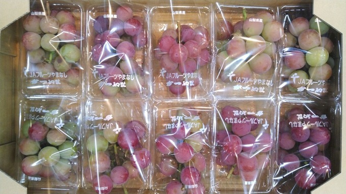
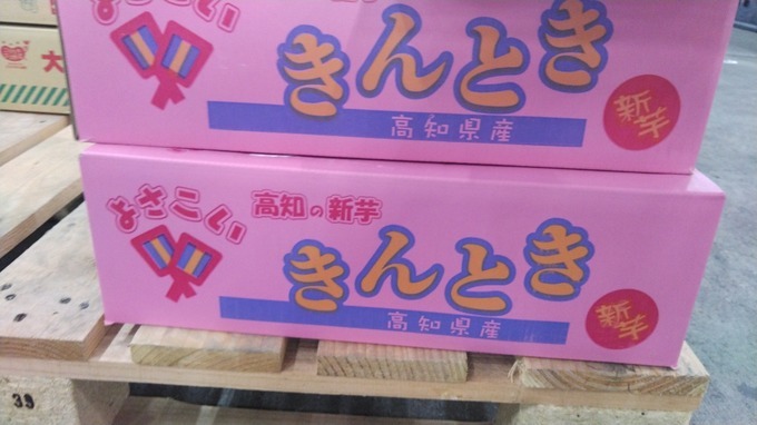
Gokyogoku grape (formerly Golby grape) was copulated at the Uehara Grape Research Institute in Zenkoji, Kofu City, Yamanashi Prefecture in 1983, and first bred in 1988. It is characterized by its large, bright crimson color, firm flesh and vivid sweetness. The skin of wine red is beautiful, and it seems that the average sugar content is about 18 degrees and the average temperature is about 20 degrees. Although it looks similar to Aki Queen grapes, it has a firmer flesh than Aki Queen, and has become popular and popular in recent years as a large-grain grape with no seeds and a high sugar content. It seems that the name of Gorby grapes was derived from the nickname of Mr. Gorbachev of the former Soviet Union.
Katsunuma is the birthplace of Koshu grape cultivation. It is said that 1300 years ago, when it originated in Europe, it landed in Japan (Koshu City, Yamanashi Prefecture) via the Silk Road along with the East-West trade. It seems that there are various theories about the origin of Koshu grapes in Japan from ancient times. Koshu grapes, which are purple-red, rich in fruit powder, and have a unique color, are one of the representative varieties of Yamanashi prefecture, where you can enjoy moderate acidity and slight astringency. You can still enjoy the taste of 1300 years ago because of the warm and warm climate peculiar to the Kofu Basin surrounded by rich mountains.
In 718, when the monk Gyoki visited Kai no Kuni, he approached Katsunuma's Kashiwao and practiced on a large stone in the valley of the Hikawa River. buddha able to cure all ills) seems to have appeared. Gyoki was delighted with the dream, and immediately engraved the same statue of his bhaisajyaguru (buddha able to cure all ills) that appeared in the dream and placed it at Shingon-shu Chisan-ha's Grape Temple Kashiosan Daizenji. It seems.