Shigeru (Bokusui) loved sake, nature, and cherished his family.
Designated as a national hot spring resort by the Ministry of Health and Welfare Notification No. 65 (at that time) on March 10, 1962.
Hatake Onsen is an alkaline simple spring with a water temperature of 34 degrees, and is known as a hot spring that is effective for high blood pressure and neuralgia. Bokusui first visited this place in September 1922. This place has been popular as a hot spring resort since ancient times, where people can relax and soak for long periods in the warm water. 『長湯して飽かぬこの湯のぬるき湯に ひたりて安きこころなりけり』
【Product name】
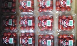
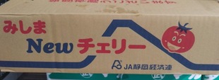
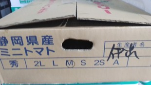
Mishima New Cherry
【Type】
Solanum lycopersicum var. cerasiforme
【Origin of name】
Because we are aiming for a discerning mini tomato that is chosen by consumers.
【Production area】
Mishima City, Shizuoka Prefecture, Kannami Town, Tagata District (JA Fujiizu, Old JA Mishima Kannami, JA Shizuoka Economic Federation)
【Main features】
In early July 2022, Mishima City launched the "Mishima Morning Trip" website, which travels around the city in the early morning, on the website of the City Tourism Association, and is refocusing on promoting tourist attraction and excursions. Information on recommended courses that incorporate the rich nature of the city center, restaurants that serve breakfast, etc. is posted to convey the charm of a refreshing morning that is a bit different from the daytime. Historic sites and nature such as Mishima Taisha Shrine and Genbei River are scattered in the city, and NPO corporations and citizen groups also regularly hold "Mishima Morning Walk" events. Izu Shonan Road Concept: According to materials from both Shizuoka and Kanagawa prefectures, the Izu Shonan Road is a 30km road that connects the eastern part of Shizuoka prefecture to the western part of Kanagawa prefecture. Proceed east from the Kannami IC (tentative name) on the Izu Jukan Expressway planned in Kannami Town, Shizuoka Prefecture, and reach Seisho Bypass and Odawara Atsugi Road in Odawara City via Atami City, Yugawara Town and Manazuru Town in Kanagawa Prefecture. It seems that a route is being envisioned. As of 2022, in order to go back and forth in this section, it seems that you will have to make a major detour to the Tomei Expressway, or take National Highway No. 1, Hakone Turnpike, Nekkan Road, National Highway No. 135, etc. “Mishima City, Shizuoka Prefecture”, Located at the base of Izu Peninsula in the south foot of Mr. Fuji and Hakone western foot.At the eastern end of the area called the Tokai region, crossing Hakone is the Kanto region. In the olden days, it prospered as a post town of Tokaido, a town in front of Mishima Taisha Shrine(Minamoto no Yoritomo prays for Genji revival; Worshipped deity-大山祇命, 積羽八重事代主神). It is also the 11th post town of The fifty-three stations of the Tokaido(Imperial fief of the Edo Shogunate; 大中島町, 小中島町, 久保町, 大中島, 小中島, 伝馬町, 金谷町, 宮倉町, 長谷町, 六反田町, 蓮行寺町, 新宿町, 木町, 茶町, 後(浦 /裏), 柴(芝)町, 唐人町, 新町三島宿 etc.). In the center of the eastern volcanic belt of the prefecture: To the north, Fuji (mt. Fuji 3,776.3 m), Ashitaka (Mt. Echizendake 1,505.5 m)-Both volcanoes.Hakone on the east side (Kamiyama 1,438.2 m, Taga (Mt. Kurotake 799.1 m, Amagi(Mt. Banzaburotake, Mt. Banjirotake)etc. Volcanoes line up north and south, and Enoura (Mt. Washizu 392 m) is on the west side, Mt. Daruma 981.9 m, Mt. Nekogoe 1,034.7 m etc. The volcano is parallel to this.Orient and Occident-The Kanogawa River (47.15 km) flows through the alluvium between the two volcanic groups. Japan National Route 136 runs along this line. The city area is about 15 to 20 meters above sea level. In the north, the Sano Area is 100 m above sea level, gently climbing the mountain skirt of Hakone / Ashitaka. To the east, the entrance to Tsukahara Shiden is 110 m, and Yamanaka Shiden is 580 m: The steep slope west of so-called Hakone. Alluvial plain of the Kanogawa River from south to west: The Mishima / Numazu plain is open. According to research, it was the fuji Volcanic belt that gave birth to hakone and Izu Peninsula. Fossa magna: Along this line, there are two major geological rifts in Japan; Southwest japan (southwest of the itoigawa-shizuoka tectonic line) and Northeast Japan (northeast of the Itoigawa-Shizuoka Tectonic Line) . In addition, it has been said to be a region where more geology can be seen than in ancient times. Near Mishima station-You can see many rocks full of holes that appear on the surface of the earth. This is called the bed-rock (Mishima lava flow) of Fuji volcano. This lava flow goes down to Mishima along the Gotemba line with a width of about 2 km. The southern end is said to reach the center of the city. Suisenen's rock is the end of the outcrop: It extends to 90m in the thick part of this lava flow. Alluvium in the south: This created the Mishima-Numazu Plain, which spread further south to become the “Tagata Plain”. The eastern highlands are covered with ejecta from Hakone volcano: Volcanic ash and pumice flow. Yugawara volcanic ejecta can also be seen around Mitsuya and Tsukahara. The western part is covered with volcanic ash and pumice to the west bank of the Kisegawa River outside the city. It is said that you can see the ejecta of Ashitaka volcano in the highlands. Fuji-Hakone-Izu National Park-Born in 1936. It is divided into an area centered on Mt. Fuji and an area centered on Hakone. “Mishima” is the western entrance to the area centered around Hakone. In 1955, Izu Peninsula was added and it became a new park. “水の郷百選”, Mt. Fuji's subsoil water springs up everywhere and flows through the city. The water system is divided into three: Sakai River (Oba River), Sawaji River, Yamada River, Takekura River, Natsumegi River: All of these rivers originate at the western foot of Hakone: Irrigation water in the Sano / Kitakami / Nishikita area: It joins the Oba River and pours into the Kano River. The second water system is the spring water of Rakujuen, Komoike, and Shirataki Park. Becomes Genbei River and Sakura River and flows to the western part of Nakago: It runs through the city (City of Water). Clean groundwater called Fuji's thaw water is coming out from between the Fuji lava. Under this Fuji lava-It has abundant groundwater and is the best as drinking water and industrial water. But, the water warming pond was created in 1953 because it is too cold for irrigation water. The Kakida River in Shimizu Town is scattered in this water system. Third water system: Irrigation water in the eastern part of Nakago, Kannami Town: Kannami Town The water source is emitted from the forbidden forest (protection forest for water source) in Kuwahara: Collect the spring water from the tanna tunnel on the way to become the Raiko River. This forbidden forest is a natural forest that has long been forbidden to be logged. It has an area of 327 ha and many types of trees. In autumn, the autumn leaves shine in the setting sun and it is a beautiful sight. Route 1 (Iceland) and Japan National Route 136, which passes through the center of Izu, intersect. The transportation center of the eastern region, both in the past and in the present. Shizuoka Prefecture is located between the two major cultural areas of Kanto and Kansai: It is said to be an exchange zone between both cultures. The boundary between the Kansai valve and the Kanto valve seems to be in the western part of the prefecture. The seasoning of Kanto style such as Udon and the seasoning of Kansai style may change. The city belongs to the Kanto area. According to the Metropolitan Area Development Law, Mishima is the western end with a radius of 100 km: It is completely in the Kanto living area centered on Tokyo. However, although the living area belongs to the Kanto region, it has a geographical corridor. It has the advantage that you can choose either east or west depending on market conditions, such as shipping vegetables. Another regional feature is the cultural and economic center of North Izu.Cultural property : 国指定国宝(工芸品), 梅蒔絵手箱, 昭和27年11月22日, 大宮町, 国指定国宝 (工芸品), 薙刀, 銘備前国長船住人長光造, 昭和32年2月19日, 中田町, 国指定重文(工芸品)太刀, 銘宗忠, 明治45年2月8日, 大宮町, 国指定重文(工芸品)脇指, 銘表ニ相模国住秋義 伊豆三島大明神 裏ニ 奉拝佐藤松千代貞成, 大正9年4月15日, 大宮町, 国指定重文(工芸品)短刀, 表ニ三島大明神他人不与之 裏ニ貞治三年藤原友行ノ銘アリ, 明治44年4月17日, 大宮町, 国指定重文(工芸品)太刀, 銘長元, 昭和27年3月29日, 中田町, 国指定重文(工芸品)短刀, 銘国光, 昭和32年2月19日, 中田町, 国指定重文(工芸品)刀, 無銘正宗, 昭和36年2月17日, 中田町, 国指定重文(工芸品)刀, 朱銘義弘(名物松井郷)本阿(花押), 昭和29年3月20日, 中田町, 国指定重文(工芸品)刀, 金象嵌銘備前国兼光(名物大兼光)本阿弥(花押), 昭和34年6月27日, 中田町, 国指定重文(工芸品), 秋草文黒漆太刀 中身銘豊後国行平作, 昭和28年11月14日, 中田町, 国指定重文(美術品)太刀, 銘行秀, 昭和30年6月22日, 中田町, 国指定重文(絵画), 絹本著色日蓮上人像, 大正8年8月8日, 玉沢, 国指定重文(絵画), 絹本著色十界勧請大曼荼羅図(絵曼荼羅), 大正9年4月15日, 玉沢, 国指定重文(彫刻), 木造大日如来坐像, 明治32年8月29日, 中田町, 国指定重文(書跡)注, 法華経 (開結共) 日蓮自注, 昭和27年7月19日, 玉沢, 国指定重文(書跡)撰時抄 日蓮筆, 昭和27年7月19日, 玉沢, 国指定史跡, 山中城跡, 昭和9年1月22日, 山中新田, 国指定史跡, 伊豆国分寺塔跡, 昭和31年5月15日, 泉町, 国指定天然記念物, 三嶋大社のキンモクセイ, 昭和9年5月1日, 大宮町, 国指定天然記念物 / 名勝, 楽寿園, 昭和29年3月20日, 一番町, 国指定重文(書跡), 般若心経(源頼家筆), 平成6年6月28日, 大宮町, 国指定重文(古文書), 三嶋大社矢田部家文書, 平成6年6月28日, 大宮町, 国指定重文(建造物), 三嶋大社本殿/ 幣殿及び拝殿, 平成12年5月25日, 大宮町, 国指定史跡, 箱根旧街道, 平成16年10月18日, 箱根町, 三島市, 函南町, 県指定工芸刀, 銘荘司筑前大掾大慶藤直胤(花押)天保二年仲秋イツ(刻印), 昭和41年3月22日, 一番町, 県指定工芸刀, 銘繁慶, 昭和41年2月7日, 中田町, 県指定工芸, 三十六歌仙図刺繍額, 平成27年11月9日, 大宮町, 県指定彫刻木造阿弥陀如来立像, 平成25年11月19日, 県指定絵画紙, 本著色白隠自画像, 昭和45年6月2日, 沢地, 県指定絵画, 楽寿館 / 楽寿の間絵画, 昭和55年11月28日, 一番町, 県指定典籍, 聚分韻略, 昭和52年3月18日, 文教町, 県指定典籍, 日本書紀並びに具書, 昭和55年11月28日, 大宮町, 県指定天然記念物, 駒形諏訪神社の大カシ, 昭和46年3月19日, 山中新田, 県指定天然記念物, 御嶽神社の親子モッコク, 昭和46年3月19日, 青木, 県指定無形民俗, 三嶋大社のお田打, 昭和47年3月24日, 大宮町, 県指定無形民俗, 三島囃子, 平成3年3月19日, 川原ケ谷, 県指定史跡, 向山古墳群, 平成11年3月15日, 谷田北沢, 市指定考古資料, 市ヶ原廃寺の塔心礎, 昭和41年2月7日, 大社町, 市指定典籍, 河合家所蔵 三嶋暦及び版木並びに関係文書, 昭和41年2月7日, 大宮町, 一番町, 市指定工芸, 龍澤寺隠寮内 入江長八鏝細工, 昭和41年2月7日, 沢地, 市指定絵画, 小沼満英筆 三島宿風俗絵屏風, 昭和41年2月7日, 芝本町, 市指定建造物, 三嶋大社舞殿,神門及びそれに属する彫刻, 昭和41年2月7日, 大宮町, 市指定建造物, 玉澤妙法華寺庫裡, 昭和41年2月7日, 玉沢, 市指定工芸, 織部どうろう, 昭和41年2月7日, 南本町, 市指定天然記念物, 愛染院跡の溶岩塚, 昭和41年2月7日, 一番町, 市指定典籍, 秋山家所蔵 秋山富南古文書 原本豆州志稿他, 昭和43年10月1日, 安久, 一番町, 市指定典籍, 樋口家所蔵三島宿本陣関係史料, 昭和45年2月14日, 南本町,一番町, 市指定史跡, 千枚原遺跡, 昭和46年5月4日, 千枚原, 市指定建造物, 楽寿園内楽寿館, 昭和49年11月20日, 一番町, 指定建造物, 玉澤妙法華寺中鐘楼, 昭和54年12月1日, 玉沢, 市指定絵画, 栗原忠二画「月島の月」, 昭和55年10月8日, 一番町, 市指定彫刻金剛力士像(阿形像,吽形像), 昭和57年2月23日, 玉沢, 市指定工芸, 三四呂人形, 昭和58年10月7日, 一番町, 市指定天然記念物, 神明宮神社 社叢, 昭和60年11月11日, 御園, 市指定天然記念物, 中のカシワ, 昭和60年11月11日, 中, 市指定天然記念物, 願成寺クス, 昭和60年11月11日, 川原ケ谷, 市指定天然記念物, 耳石神社イタジイ, 昭和60年11月11日, 幸原町, 市指定彫刻, 光安寺鼻取り地蔵, 昭和62年3月19日, 日の出町, 市指定建造物, 円明寺表門(伝樋口本陣表門), 昭和63年1月21日, 芝本町, 市指定考古資料, 光安寺板碑, 平成2年3月6日, 日の出町, 市指定絵画, 梅御殿装飾絵画「杉戸絵」, 平成3年3月4日, 一番町, 市指定考古資料, 向山古墳出土遺物(鉄製品), 平成3年3月4日, 大宮町, 市指定天然記念物, 三嶋大社 社叢, 平成3年3月4日, 大宮町, 市指定考古資料, 吊手土器, 平成4年3月3日, 大宮町, 市指定天然記念物, 矢立の杉, 平成4年3月3日, 山中新田, 市指定絵画, 下田舜堂画 「朝焼けの富士」, 平成5年3月4日, 北田町, 市指定絵画下田舜堂画 「小浜池」, 平成5年3月4日, 北田町, 市指定絵画, 細井繁誠画 「月と芋畑」, 平成7年3月1日, 大宮町, 市指定絵画, 杉本英一画 「絵画教室」, 平成7年3月1日, 大宮町, 市指定歴史資料, 扁額 「三島黌」, 平成9年3月5日, 一番町, 東町, 市指定歴史資料, 「豆州伊豆佐野村」絵図, 平成12年3月1日, 佐野, 市指定典籍, 世古文書, 平成14年3月1日, 相模原市, 一番町, 市指定考古資料, 箱根田遺跡出土祭祀関係遺物, 平成15年5月8日, 中央町, 市指定歴史資料, 花島家資料, 平成15年5月8日, 一番町, 市指定建造物, 経王山 妙法華寺伽藍 (大書院 / 本堂 / 祖師堂 / 奥書院 / 中門 / 忠霊殿), 平成15年5月8日, 玉沢, 市指定絵画, 芹沢晋吾画 「農夫」, 平成19年1月10日, 大宮町, 市指定典籍, 落合家文書 「天正十八年 『豆州君澤郡中嶋郷御縄打水帳』 外地方文書」, 平成21年10月15日, 一番町, 市指定建造物, 禅叢寺鐘楼門, 平成22年3月10日, 玉川, 市指定絵画, 大沼貞夫画 「日輪ボロブドゥール幻想」, 平成22年3月10日, 大宮町, 市指定絵画, 大沼貞夫画「魔性と仏性(ボロブドゥール考)A / B」, 平成22年3月10日, 一番町, 市指定典籍, 接待茶屋関係文書, 平成23年3月9日, 一番町, 市指定歴史資料, 接待茶屋関係調度品大茶釜外3点, 平成23年3月9日, 一番町, 市指定古文書天正十八年 豊臣秀吉掟書, 平成25年3月6日, 一番町, 市指定天然記念物, 鏡池横臥溶岩樹型, 平成26年10月9日, 一番町. “Kannami Town, Tagata District”, Located at the gateway to the Izu Peninsula in the eastern part of the prefecture. It has a scenic terrain and a warm climate overlooking Mt. Fuji, south of Hakone. You can see the rich green nature at the southern foot of Hakone and the beautiful Fuji from anywhere. Kannami Wisdom Center for child-rearing exchange center in Japanese-style building-Providing child-rearing support measures that match the needs of child-rearing households. There is also a library: A large collection of large picture books for children: We are preparing an environment where you can relax and get familiar with books. 文化財の指定状況(平成27年4月1日現在, 資料:生涯学習課), 山中城(岱埼出丸): 史跡, 昭和9年1月22日, 桑原字城山, 国指定. 柏谷横穴群 : 史跡, 昭和51年2月20日, 柏谷字池頭向山, 国指定.柏谷横穴群: 史跡, 平成10年7月31日, 柏谷字池頭向山,追加指定, 丹那断層, 天然記念物. 昭和10年6月7日, 畑字乙越, 国指定. 木造阿弥陀如来及両脇侍像, 重要文化財 , 平成4年6月22日. 桑原かんなみ仏の里美術館, 国指定.箱根旧街道, 史跡, 昭和35年9月22日, 箱根旧街道, 国指定, 箱根旧街道 : 史跡, 平成16年10月18日, 箱根旧街道追加指定.天地神社のクス, 天然記念物.昭和27年4月1日, 平井天地神社境内, 県指定.春日神社のクス, 天然記念物, 昭和29年1月30日, 大竹春日神社境内, 県指定. 木造薬師如来坐像彫刻, 昭和52年3月18日, 桑原かんなみ仏の里美術館, 県指定. 木造毘沙門天立像彫刻, 平成13年3月15日, 桑原かんなみ仏の里美術館, 県指定. 木造十二神将立像彫刻, 平成13年3月15日.桑原かんなみ仏の里美術館, 県指定木造聖観音立像 / 木造地蔵菩薩立像彫刻, 平成13年3月15日. 桑原かんなみ仏の里美術館, 県指定, 火雷神社の断層, 天然記念物, 昭和56年7月25日, 田代火雷神社, 町指定. 八重窪横穴群, 史跡, 昭和56年7月25日. 大竹八重窪, 町指定, 中里横穴群, 史跡, 昭和56年7月25日, 日守, 中里町指定興聖寺の襖絵絵画, 昭和58年3月16日. 塚本興聖寺, 町指定, 興聖寺のマリア観音像, 彫刻, 昭和58年3月16日. 塚本興聖寺, 町指定, かんなみ仏の里美術館内の仏像群彫刻, 昭和59年11月8日, 桑原かんなみ仏の里美術館, 町指定, 磨崖仏彫刻, 平成1年11月24日, 畑毛, 町指定.双体道祖神民俗, 平成1年11月24日, 田代, 町指定.駒形像民俗, 平成1年11月24日, 軽井沢, 町指定.地獄 / 極楽絵図民俗, 平成6年1月28日, びんの沢法伝寺, 町指定, 火雷神社の社叢, 天然記念物. 平成6年8月10日, 田代火雷神社, 町指定. 大竹千体観音像, 彫刻, 平成25年3月1日, 大竹, 町指定. 三拾三躰民俗, 平成26年3月31日.桑原長源寺内, 町指定, 寺社版木等民俗, 平成26年12月18日, 桑原かんなみ仏の里美術館, 町指定. Kannami Brand: By June 2018, 38 products have been selected. Typical examples are high sugar content, strong aroma and crispy texture - “Kannami watermelon”: Boasting a history of more than 130 years of dairy farming, it is also provided for school lunches- “Tanna Milk” that is familiar to many people. Stayed at Hatake hot spring(いずみ荘)from September 1922. “長湯して飽かぬこの湯のぬるき湯にひたりて安き心なりけり”, 人の来ぬ夜半をよろこびわが浸るいで湯あふれて音たつるかも - By written Bokusui(茂)Wakayama. 27 Sing the neck. Hot spring health resort - Located in a quiet countryside, it has been popular as a spa since the early Edo period. “Mishima New cherry”, Tomato cultivation in Mishima began in the late 1950s. In the 30's of the Showa era, the number of green house growers increased. In 1972, it was designated as a production area for winter and spring tomatoes as a designated vegetable production area “Mishima”. Production has been strengthened, and since the 1970s, many new technologies such as hydroponic culture have been introduced. Currently from Mishima-Kannami, Produced and shipped mini tomatoes "Mishima NEW Cherry Tomatoes", high sugar content tomatoes "JA Mishima Kannan Fruit Tomatoes", round ball tomatoes "Mishima Kannan Sweet Ripe Tomatoes", etc. are produced and shipped stably. Mishima winter spring tomato harvest: From October to June, from spring to early summer, the sugar content increases as the temperature rises. It is mainly shipped to Keihin and Chukyo areas. Due to the long shipping period, we will hold several meetings within the year. Important work to reconfirm shipping standards and quality. Don't forget to measure the sugar content by comparing it with cherry tomatoes from other production areas. Work hard to be chosen by consumers: To work hard and encourage each other.
Cultivation of tomatoes in Mishima began in the latter half of the 1945s, and in the 1955s, the number of greenhouse growers increased. Since the 1980s, many new technologies such as hydroponics have been introduced. The Shizuoka Agriculture, Forestry and Fisheries Certification System is a system started by Shizuoka Prefecture in 2006 with the aim of ensuring the peace of mind and trust of the citizens of the prefecture for agriculture, forestry and fishery products. It is a system in which the prefecture certifies the efforts of producers of agriculture, forestry and fishery products for safety and security, and is targeted at individuals, corporations or production organizations that produce agriculture, forestry and fishery products in the prefecture. Items subject to certification are agricultural products (vegetables, rice, fruit trees, green tea, flowers), special forest products (mushrooms), livestock products (dairy cows, beef cattle, pigs, hens, broilers), marine products (eels, sardines, etc.) Inspiration). It seems that other items will be gradually expanded. A certificate will be issued to those who have passed the certification examination conducted by Shizuoka Prefecture. The certification validity period is three years, and it seems that regular audits are conducted to see if the certified system is operating properly during this period. Those who have obtained the certification are allowed to register on the dedicated website "Fuji no Kushizuoka Food Information Center" to send out information on production and safety management, and to use the certification mark. JA Mishima Kannami is a target item mini tomato with a certification date of March 18, 2021. This certification system requires that a PDCA (Plan, Do, Check, Act) management system be implemented in order to ensure and continuously execute safety management, etc., and certification holders must use manuals and records. Prepare documents etc. This makes it possible to properly explain the producer's safety management efforts to consumers and the like. It seems that the prefecture conducts an annual examination to confirm that the system for ensuring the safety of certified persons is properly operated. This enhances the reliability of the system. Disseminate information on certification and efforts for safety and security by utilizing certification marks. This seems to be able to effectively lead to the peace of mind and trust of consumers.
Since tomatoes are produced in greenhouses, it seems that the number of tomatoes planted in one house is fixed to some extent. Therefore, it seems that the decisive factor is how much the yield can be increased. Even now, MC (Integrated Environment Control: Control by linking multiple devices such as skylights, heating, and curtains. Creates a balanced environment without waste according to changes in the weather such as wind direction, wind speed, and solar radiation. Greenhouse measured with the set contents Control based on internal and external data. For example, in the afternoon of a day when solar radiation is strong and photosynthesis is active, the control temperature of the skylight and heating can be automatically corrected to promote the translocation of sugar produced by photosynthesis. It seems. It is expected that the optimum environment will be created by making an integrated judgment instead of making a judgment based on one environmental factor, and it is expected that the quality will be improved and the yield will increase. Since it automatically controls the opening and closing of skylights and curtains, heating, etc., it was said that it was opening and closing while watching the weather every day, changing the timer setting frequently, and rushing to the green house when it rained. Reduces the work load on the person. The work efficiency is improved because it is used for work such as the care of crops. Also, the input resources are used efficiently. For example, when the temperature inside the greenhouse is low and the skylight is closed. Applyes carbon dioxide gas at a high concentration to promote photosynthesis, and when the skylight starts to open due to a rise in temperature, the concentration is lowered to stop unnecessary application, and resources are used efficiently.), Fertilizer management, water management, etc. It seems that some farmers are promoting IOT with methods that do not involve human hands as much as possible.
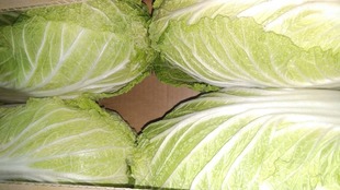
The JA jurisdiction is blessed with a warm climate with a lot of solar radiation even in winter, with an average annual temperature of 16.2 degrees Celsius and an annual rainfall of 1826 mm. About two-thirds of the area consists of mountainous hills, which are roughly divided into hills with the foot of Mt. Hakone at the top and flat lands formed by the Kano River basin on the south side. In the plains, it is a paddy field area, and it seems that facility horticulture such as strawberries and tomatoes has been actively carried out. In the hills on the west side of the western foot of Hakone, a wide variety of vegetables such as potatoes, carrots, sweet potatoes, Chinese cabbage, and lettuce are produced. This area of surface humus andosols is blessed with fertile soil and has a history and romance that has produced very good quality agricultural products since ancient times.


