Translate

Sunday, April 21, 2024

A man who has committed a mistake and doesn’t correct it is committing another mistake. Competing for the brilliance that doesn't suit the samurai, and forgetting the path of pen and sword, there was a frivolous and frivolous behavior, and the decadence of the samurai style was enormous: Confucius's Analects; Craftsmen work at their studios. Gentlemen accomplishes their way by learning-Tadaari (Ohseidasaresho(後の太政官布告第214号(被仰出書 / 学制布告書)8.2 1872 ): People have their own strengths and weaknesses, so teachers should guide them to develop their strengths. ), Tadakata (Thought of Sorai Ogyu) ≒ Chido Palace

Princess Himiko ≒ 魏志倭人伝→襄荷

【Product name】

japanese zinger

【Type】

Zingiber mioga (Thunb.) Roscoe

【Producing area】

Part of Tsuruoka City, Yamagata Prefecture (former Atsumi Town, former Fujishima Town, former Haguro Town, former Kushihiki Town, former Asahi Village), Shonai Town, Higashitagawa District (former Amarume Town, former Tachikawa Town), Mikawa Town (JA Shonai Tagawa, Delicious Yamagata)

【Origin of name】

The Buddha's disciple (one of the sixteen Arhats), Shuri Handoku Chula Pantaka, was very poorly remembered and sometimes even forgot his name. So I wrote my name and hung it around my neck. After his death, grass grew in the graveyard, so he named it 名荷; 茗荷.

【Major features】

The Shonai Town, Higashitagawa District election (Yamagata Prefecture) was announced on June 14, 2022 due to the expiration of the term of office, and 20 people will run for the fixed number of 14, 14 incumbents, and 6 newcomers will fight. By party, there are 1 communist, 19 independents, and 5 women. In the 2018 election for the same town, a total of 15 people, including 12 incumbents and 3 newcomers, ran for a fixed number of 16, and all of them were elected without voting. By party, there were 1 communist, 14 independents, and 2 women (parties at the time of the election). Voting will be on June 19th and will be counted on the same day. As of June 13, the number of registered voters is 17,532 (according to the Shonai Town Election Commission). A total of 20 people, 14 incumbents and 6 new faces, are preparing for the candidacy, and it is certain that the election contest will be held. Last time in 2018, only 15 people ran for the fixed number 16, and there was no vote due to "breaking the fixed number". In July 2021, Mikawa Town issued the local currency "Na(菜)no Ca" for the first time as a measure to stimulate consumption, which has been sluggish due to the spread of the new coronavirus infection. Repeatedly used by an unspecified number of people and business establishments in the form of banknotes. The full-scale introduction of local currencies issued by local governments is a rare case in Tohoku. 1 Na no Ca = 1 yen "Na no Ca" is issued by the town for 26 million yen, and the Dewa Chamber of Commerce and Industry Mikawa branch operates the business. A total of about 120 places, including restaurants and retail stores in the town, were expected to participate in the project. When shopping at participating business establishments after July 10, Nanoka was issued according to the payment amount, and a de facto discount was received. The grant ratio is 200 Na no Ca for every 500 yen (tax included) paid by restaurants, 500 Na no Ca for every 1500 yen for retail stores and service industries, and 1500 Na no Ca for every 5000 yen for the construction industry. The de facto discount rates were 40%, 33% and 30%, respectively. There are three types of banknotes: 200 Na no Ca, 500 Na no Ca, and 1500 Na no Ca. The name seems to be named after the town flower "rape blossoms". The Na no Ba received was available at any participating establishment. It was expected to be used in combination with cash because no change was made. The establishment could give Na no Ca again as change to another customer, and it seems that a certain amount could continue to circulate in the city. The expiration date was until February 27th (Sun) next year. Participating business establishments can redeem every Friday, and the final redemption date is set in early March of the same year. It seems that the town wants to be computerized in the future and become a permanent local currency. The Funds Settlement Law excluded gift certificates such as "local currency" issued by local governments. It seems that the Tohoku Local Finance Bureau cannot grasp the whole picture of the "local currency" issued by the local government. The person in charge of the town said, "It should be rare in the whole country for the local government to issue the local currency of banknotes in earnest. Unlike the point redemption of "QR code" payment and gift certificates, the mechanism that money continues to circulate in the town I wanted to make it." Shonai Plain, Yamagata Prefecture - It is nurtured by the flow of the mogami river and Akagawa river from different sources. To the north Mt. Chokai : Dewa Sanzan (Three Mountains of Dewa ; Shrine - Mt. Haguro, Mt. Gassan, Mt. Yudono) to the east - It is said that Koteko's son, Prince Hachiko, escaped from the capital at the discretion of Prince Umayado (Prince Shotoku), and became the founder of Dewa Sanzan (Three Sacred Mountains of Dewa) in Tsuruoka City, Yamagata Prefecture. South is surrounded by mountains in the Asahi mountain range(寒江山, 小朝日岳, 平岩山, 鳥原山, 祝瓶山 etc.)- One of Japan's leading granary areas, with large sand dunes on the west side facing the Sea of Japan. Humans settled in the Region as far back as the Paleolithic and Jomon periods. Southern hills and foothills : The ruins of hunting life at that time are interspersion. In the Kofun period, people also settle in the lowlands of the plains. He started his rice-growing life under the control of a powerful family. At the end of the Heian period, a manor called Oizumi-sho was set up in this region. “Gikeiki”, 大泉荘大梵寺を通せ給ふ - Description, Daibon-ji Temple later became known as Daiho-ji Temple.Eventually it will become the center of Oizumi-sho. At the beginning of the Kamakura period, Mr. Muto ruled as lord of a manorof Oizumi-sho. Since then, it has prospered as a regional center throughout the Middle Ages : In the 1530s, seeking harm during the war : Take up residence at Oura Castle (now Oyama). From the Middle Ages, Mt. Haguro was a major force here. It is said that he also served as a steward and protected Kurokawa thickly(Inherited for more than 500 years by the parishioner ; It is divided into an upper seat and a lower seat, which are Noza (farmer) of the guardian Kasuga Shrine. Oral biography of the 56th Emperor Seiwa. Designated in 1976 as a national important intangible folk cultural property.). After the fall, Shonai will be under the control of Echigo Uesugi. In 1591, Kanetsugu NAOE built Daihoji Castle as a political base. The Naoe army attacked the Yamagata Castle fiercely, and finally besieged the Hasedo Castle, the advance-guard station of the Yamagata Castle (the Battle of Dewa in the Keicho Era or the Battle of Hasedo-jo). As a result of the Battle of Sekigahara, Yoshiaki Mogami-Ko, the lord of Yamagata, ruled Shonai in 1601. Daihoji Castle is maintained as a retired castle: In 1603, the name was changed to Tsurugaoka Castle. Entering the Edo period, Mr. Mogami was confiscated in 1622.Instead, Tadakatsu Sakai(140,000 koku ; of rice in Fudai Daimyo)entered the country as the lord of the Shonai clan. The castle town is maintained with Tsuruoka as the residence -To build on the basics. The Shonai clan has Akumi District and Tagawa District. This is administratively divided into Kawakita Misato and Kawanami Five Streets. 中川通, 櫛引通, 京田通, 山浜通 - The Shonai clan was ruled by the Sakai clan for about 250 years. From the Restoration down to the present. In 1869, Mr. Sakai repatriates the edition.etc. “the great municipal mergers of the Heisei era” - 鶴岡市, 藤島町, 羽黒町, 櫛引町, 朝日村, 温海町が合併 - 平成17年10 月1日に, 新鶴岡市が発足 - With an area of 1,311.53 km2, it is the largest city in Tohoku. Formulated a comprehensive plan in January 2010. “藤沢周平(Mr. Tomeji KOSUGE)”, Born December 26, 1937. 旧東田川郡黄金村大字高坂 ; Section of village
Takasaka, Tsuruoka City- 暗殺の年輪, 1973 ;文藝春秋, 又蔵の火, 1974 ; 文藝春秋, 闇の梯子, 1974 ; 文藝春秋, 檻車墨河を渡る, 1975 ; 文藝春秋, 改題: 雲奔る 小説 / 雲井龍雄 ; 中公文庫, 竹光始末, 1976 ; 新潮文庫, 時雨のあと, 1976 ; 新潮文庫, 義民が駆ける, 1976 ; 中央公論社, 講談社文庫, 冤罪, 1976 ; 新潮文庫, 暁のひかり, 1976 ; 文春文庫, 逆軍の旗, 1976 ; 文春文庫, 喜多川歌麿女絵草紙, 1977 ; 講談社文庫,闇の穴, 1977 ; 新潮文庫, 闇の歯車, 1977 ; 講談社, 長門守の陰謀, 1978 ; 講談社文庫, 春秋山伏記, 1978 ; 家の光協会, 角川文庫, 一茶, 1978 ; 文藝春秋, 神隠し, 1979 ; 新潮文庫, 雪明かり, 1979 ; 講談社文庫, 回天の門, 1979 ; 文藝春秋, 驟り雨, 1980 ; 新潮文庫, 橋ものがたり, 1980 ; 新潮文庫, 出合茶屋 神谷玄次郎捕物控, 1980 ; 双葉社, 改題: 霧の果て, 1985 ; 文春文庫, 闇の傀儡師, 1980 ; 文藝春秋, 夜の橋, 1981 ;文春文庫, 時雨みち, 1981 ; 新潮文庫, 霜の朝,1981 ;新潮文庫,密謀,1982 ; 新潮文庫, よろずや平四郎活人剣, 1983 ; 文藝春秋, 龍を見た男, 1983 ; 新潮文庫, 海鳴り, 1984 ; 文藝春秋, “白き瓶-小説 / 長塚節”, 1985 ; 文藝春秋, 花のあと, 1985 ; 文春文庫, 風の果て, 1985 ; 文春文庫, 決闘の辻: 藤沢版新剣客伝, 1985 ; 講談社,潮田伝五郎置文, 1985 ; 東京文芸社, 本所しぐれ町物語, 1987 ; 新潮文庫, 蟬しぐれ, 1988 ; 文藝春秋, たそがれ清兵衛, 1988 ; 新潮文庫, 市塵, 1988 ; 講談社(日本歴史文学館), 麦屋町昼下がり, 1989 ; 文藝春秋, 三屋清左衛門残日録, 1989 ; 文藝春秋, 玄鳥, 1991 ; 文藝春秋, 天保悪党伝, 1992 ; 新潮文庫, 秘太刀馬の骨, 1992 ;文藝春秋, 夜消える,1994 ; 文春文庫, 日暮れ竹河岸, 1996 ; 文藝春秋, 漆の実のみのる国, 1997 ; 文藝春秋, 静かな木, 1998 ; 新潮社, 未刊行初期短篇, 2006; 文藝春秋- 鶴岡市青龍寺金峯, 高坂字大台, 滝沢字薬師嶽, “藤沢” 字荒沢: Designated date: April 23, 1941 - Management organization name: Tsuruoka City(S17・6/23) : Historic site scenic spot natural monument - 高さ約460m, 東には羽黒山, 月山, 湯殿山の翠を列ぬるあり北には鳥海山の巍峩たる雄姿を挺んづるあり西には日本海の渺茫たるあり其の北部には飛嶋の浮べるあり頂點竝高處よりの視界に入るもの更に舊庄内の田野大半遠く連なるあり最上の長川之を串流して海に注げるあり我邦展望の壯觀として洵に稀有に屬す山上に此の如き地點多く上中下位に依つて各々其の景觀を殊にす山亦佳林を帶び其の中幽致に富める地尠からず. “鶴岡市青龍寺” - 銅造如意輪観音坐像: Prefectural designated cultural property October 25, 1955-金峯山博物館. 六所神社の獅子頭6面 : Prefectural designated tangible folk cultural property December 1, 1998. 鶴岡市教育委員会(馬場町)2002 “鶴ヶ岡城跡確認調査報告書 二の丸御角櫓跡地点” 鶴岡市埋蔵文化財調査報告書19 : 地域ルネッサンス公園整備事業遺跡 : 城館, 古代 (細分不明) 時代, 須恵器, 赤焼土器, 城館, 中世 (細分不明) 時代, 土坑, 珠洲系陶器(壺擂鉢), 越前甕, 青磁, 瀬戸(梅鉢, 皿), かわらけ, 城館, 近世(細分不明) 時代, 土塁, 二の丸外堀, 唐津(皿, 擂鉢), 肥前染付(椀, 瓶), 大堀相馬, 瓦器, 瓦, 木製品, 石製品. “Shonai Town, Higashitagawa District“, With the enforcement of the town and village system in 1889, it became Amarume Village, Goshari Village, Yamato Village, Izaai Village, Sakae Village, Karigawa Village and Tachiyazawa Village. Furthermore, in 1890, Yaezato Village was separated from Goshari Village, and in 1891, Goshari Village was renamed Joman Village, and Kiyokawa Village was separated from Karigawa Village. Amarume Village enforced the town system in 1918, Karigawa Village enforced the town system in 1937, and on October 1, 1954, 1 town and 2 villages of Tachiyazawa Village, Kiyokawa Village and Karigawa Town merged with Tachikawa Town, became. In the same year, on December 1, 1956, Amarume Town, Yamato Village, Izaai Village, Sakae Village, Joman Village, and Yaezato Village merged into Amarume Town, and on January 1, 1956, Amarume Town. The two villages of Senbonsugi and Kuwata were separated from each other and incorporated into Tachikawa Town. Then, on July 1, 2005, Amarume Town and Tachikawa Town merged to form Shonai Town. The town is located in the northwestern part of Yamagata prefecture, from the southeastern part to the center of the Shonai Plain. A long north-south terrain along the clear stream Tachiyazawa River, which has the summit of Mt. Gassan, and the Mogami River, one of the three major rapids in Japan. It borders Sakata City to the north and northwest, Tozawa Village to the east, Okura Village to the southeast, Tsuruoka City to the southwest, and Mikawa Town across the Mogami River. It is a turning point connecting the regions and a gateway to the Shonai region. The climate is generally oceanic and relatively warm, but in winter the closer to the south (Moonyama side), the heavier the snowfall, the stronger the monsoon from the northwestern part (Sea of Japan side), and From spring to autumn, the strong winds in the east-southeast from the valley of the Mogami River are famous as “Kiyokawa-Dashi(It is counted as one of the three major local winds in Japan and is a representative example of isthmus winds. The Mogami River passes through the Mogami Gorge (a gorge with a width of about 1 km and a length of about 10 km that forms the saddle of the Dewa Hills).)”. It is about 22.2 km east-west, about 38.9 km north-south, and has an area of 249.17 km2, making it the 12th largest area in the prefecture. By region, forests account for about 62.9% and rice fields account for 22.8%. “Amarume Hachiman Shrine” : This shrine is located in Amarume, Shonai Town, and was founded in 719 when it was said that it solicited the spirit of Usa Hachimangu (Usa City, Oita Prefecture, Buzen Kuniichigu). It was the vassal of Mr. Fujiwara Oshu and the deity of Mr. Sato. In the Kamakura period, Minamoto no Yoritomo gave him the title of Amarume Hachimangu Shrine, and he was the general guardian of Amarume Township. It is said that the priest of Saigoku Fudasho solicited the sand from the Saigoku Fudasho (takes the sand home) and established it as the 33 Kannon sacred sites in the Shonai region. Reorganized in 1950, there are now 35 sacred sites across the five cities of Sakata, Tsuruoka, Yuza, Shonai, and Mikawa.) It was worshiped as one of Hachiman. In the Middle Ages, Mr. Anbo ruled the area around the area, and in 1362 he relocated Amarume Hachiman Shrine as the guardian shrine of his own building. For a long time after that, it was on the site of Mr. Anbo's mansion, but in the early modern period, 1637, he moved to the site for the first time in 260 years. The current Amarume Hachiman Shrine is an old building built in 1814, and it is said that it adopted the same ceremony as the Dewasanzan Shrine Sanjingo Shrine, and the worship hall and the main shrine are integrated and the palace is enshrined inside. The exterior of the hall of worship is the hip gable roof, thatched roof, 5 girders, a large staggered gable in front, and the eaves gable is used for the 3 間’s, and the xylem is colored in various colors, mainly vermilion. The detailed sculptures are also fine and elaborate, and the wrestler statues are often seen in northern Yamagata and southern Akita prefectures, and are thought to have a strong local color. The hall of worship and the palace are the remains of the shrine building in the latter half of the Edo period and are excellent in design, so they were designated as tangible cultural properties designated by Shonai Town in 1992. There are many sacred treasures. Inakari exhibition map (votive tablet: 1 sheet) and Anbo Akiyama discussion map (votive tablet: 2 sheets) (竪矧黒塗皺韋包二枚胴具足(1領), 有栖川熾仁親王書「八幡宮」1 width) is designated as a tangible cultural property designated by Shonai Town. Religious deities: Tamayorihime, Ohohirume, Emperor Homutawake, Toyoukebime, Okinagatarashime no Mikoto. Large shrine: village shrine. “六渕/ 瀬場砂防堰堤(立谷沢地内)” : Rokubuchi and Seba, two sabo dams constructed in the 1950s. It is made of boulder concrete, the beautiful curve of the water passage part, and it was made by the high technology and skill of the time, and it is difficult to restore it now, and it seems to be a very valuable sabo dam. The words “Mokushiteyu; By Yasushi Kurakami (Former Mogami River Sabo Construction Office Construction Manager)” engraved on the back of the stone monument on the Saba Dam express the spirit of those involved in the difficult construction. In the Tachiyazawa River basin, there are many monuments to the dragon and water gods that tell the history of suffering from flooding. It was registered as a tangible cultural property registered in Japan in 2017. Nationally designated important cultural property (natural monument) : イヌワシ(くじゅう山系), Prefectural designated important cultural property (building) : 笠塔婆(柿原), 板碑(渕), 宝塔及び五輪塔(七基)(龍原), 宝塔二基(大龍), 石幢(長野), 祖霊廟宝塔二基(西長宝), オダニの車橋(櫟木), Prefectural designated important cultural property (building) : オダニの車橋, Tangible Cultural Property (Building) : 東大津留の宝塔二基(東大津留), 摺原の宝筐印塔(高岡), 田北氏宝塔(高岡), 大應寺の無縫塔(庄内原), 浄水寺の石幢(四面地蔵)(直野内山), 高岡のキリシタン墓地(高岡), 櫟木の阿南橋(櫟木), Tangible cultural property (building) : 櫟木の阿南橋, Tangible Cultural Property (Sculpture) : 木造阿弥陀如来像及び観音 / 勢至菩薩立像(渕), 天満渕神社の十一面観音像(渕), Tangible cultural property (crafts) : 天満渕神社の鰐口(渕), 永慶寺の茶釜(五ヶ瀬), Tangible cultural properties (handwriting, books, ancient documents) : 大津留家文書(大分県立先哲史料館), 田北家文書(高岡), Natural monument : 小挾間山神社のクロガネモチ(小挾間), 大分川の立木状炭化木及び火砕流(櫟木), 中臣神社の神木アカガシ(阿蘇野)), Intangible folk cultural property : 庄内神楽(庄内町). “Mikawa Town”, Located in the middle of the Shonai region on the Sea of Japan side of the prefecture, it is a flat area with a total area of about 33 km2. It faces Mt. Chokai, which is called Dewa Fuji in the north, and Mt. Gassan, a sacred mountain in the east. It is a rich place, adjacent to the castle town of Tsuruoka and the port town of Sakata. The Akagawa River, which runs along National Highway No. 7 that runs through the town, brings the blessings of the fertile land and is developing as one of the leading rice fields in the granary area, Shonai. Agricultural products other than rice, such as melons, shiitake mushrooms, and green onions, are actively produced and shipped not only locally but also to the Tokyo metropolitan area, and are highly evaluated. The town was born from Yokoyama Village, Togo Village, and Oshikiri Village. The name is derived from Sansen of the Akagawa River, Oyama River, and Fujishima River that flow through the town, and the fertile land created by each is always the yield per area even in the Shonai Plain, which is one of the leading breadbaskets in Japan. It is in the top class. The terrain of the spacious rural town is smooth, and the scenery overlooking the beautiful mountains such as Mt. Chokai and Mt. Gassan makes your heart clear. As a pure farming village from ancient times, Mikawa Town, which continues to coexist with nature, promotes and develops the region and moves forward while preserving the culture and environment that will lead to the next generation. A bone that seems to be an unknown creature, Degotsuchi (Tschinoko), is enshrined in the Soto Sect Eirinsan Kozenji Temple in a village called Zennami. In the Meiji era, when a pond in a nearby mountain was drought and brought “bones” from the bottom of the pond, unhappiness occurred one after another. According to the teachings of the shrine maiden, the discoverer gave a generous memorial service at Kozenji Temple. Is enshrined as the bone of a dragon god. In the village of Sukegawa in the town, there is a small pond called “Ono Komachi Pond”. There is a legend that Ono no Komachi was born in this area, and it was this pond that abandoned the hot water produced. It is also said that no matter how much it rains, it will not overflow. In the Oshikiri area, there is a straw-stacked Nio where a god snake called “Snake Nio” lives. A long time ago, a small straw nio flowed during the flood and stopped at the current position. Two snakes came out of it, so it was enshrined at a nearby shrine. However, at one point, the river overflowed again due to the flood and was washed away about 150 m downstream. Then, unhappiness occurred one after another in the area, and when I talked to the shrine maiden, there was a god's announcement that Snake Nio wanted to return to the previous position, and while doing so, another flood occurred, and this time it was swept away It is said that it returned to its original position. アトク先生の館(Mikawa Town Cultural Exchange Center): Known as the old house of Sanbongi. Built in the early Showa period, it was designed by Saichiro Miyajima, who also worked on imperial architecture. It is a one-story building made of cypress, with a copper plate roof, and a floor area of about 340 m2. The nickname is said to have been given by open recruitment because Tokusaburo Abe (1907-1994), who was the owner of the museum and taught at Yamagata University, was familiar with “Mr. Atoku” during his lifetime. It is said that the Ikezumi strolling garden was built in the Genroku period of the Edo period by collecting famous trees and rare stones from all over the country at a huge cost of 1,000 Ryos. Due to its design, it is known as one of the most famous gardens in Shonai. In addition to the doll displayed at Girls’ Festival being exhibited in March every year, a tea party is held in May and November with a view of the garden. It is also known as the filming location for “Departures; おくりびと,” which won the 81st Academy Award for Best Foreign Language Film; 2009, International Feature Film Award. Japanese ginger is a perennial plant of the ginger family. The place of origin is East Asia, and it is said that cultivars cultivated in China have spread to various places, and it grows naturally in Japan, China, the Korean Peninsula, and so on. The description has been confirmed in the Wei Shi Yajinden around the 3rd century. It is said that only Japanese people eat Japanese Myoga, but even in China, it is prized for stir-fry in some areas. However, it seems that Chinese Myoga is used exclusively for Chinese herbs, and I heard that only Japan grows it as an ingredient. I usually eat flower ears from the rhizome of Myoga, Flower Japanese wild ginger. Also called. Many of the items sold at retail stores and mass retailers are bright red, but at direct sales outlets, you can also see earthen and greenish Japanese ginger. In addition, there are many documents that describe that Japanese ginger was often used for the family crests of famous families in the Edo period. This was said to have been auspicious for the local affairs, such as the blessing of the gods and Buddha that they received without their knowledge. It seems that the Hosho style Nogaku performance to commemorate the 400th anniversary of the Sakai clan, the former Shonai feudal lord, was held at the Shonai Shrine in Tsuruoka City on June 14, 2022. It seems that Kazufusa Hosho, a 20-something Soke, and Mansai NOMURA, an Izumi-style kyogen master, performed a celebration. It seems that about 120 people concerned gathered in front of the shrine's hall of worship. The performance was "OLD MAN", which dances in prayer for peace reigns in the land, peace of the land, and bumper crops. It seems that the Hosho-style Mikawa family served the Sakai family as Nogaku; noh play leaders for generations.


Photo_21-07-24-06-59-47.591~2.jpg

The subcommittee in the jurisdiction is based on the original bright red standard table, and the standard is 75% or more of bright red and 1.5 cm or more in diameter, and those that have completely bloomed after flowering are removed. Also, at the time of shipment, it seems that after washing with water, it is drained sufficiently and the handle is cut to about 1 cm.


Photo_21-07-24-06-59-50.550.jpg

Although the history of Japanese ginger is so old in Japan that it is written in the "Wei Shi Yajinden" written in the 3rd century, I heard that only Japan grows it as a vegetable. It is also attractive that it can be chopped and sprinkled with dried bonito and soy sauce, used as an ingredient in miso soup, and can be used not only as a condiment but also as a single dish. Also, when boiled with eggplant, it goes very well. When I was a child, the memories I had often made and tasted by my grandmother still reappear. Young Japanese ginger stalks are cultivated without light, and the ones that are reddish by exposing them to the sun for a short time are called "Myogatake" and are said to be on the market from March to May.


Photo_21-07-24-06-59-55.706.jpg

茗荷瀬神楽: 民俗芸能の里, 庄内町には, 今でも約30の民俗芸能団体があるようだ. 地域の中で伝承されてきた芸能を絶やさないように先人達より引き継がれ, 保存活動をしている. 余目地域に伝わる神楽や近隣の鶴岡市長沼地域や酒田市新堀, 門田にも伝授されたと伝えられる歴史あるものだ. 巫女舞, 神楽舞, 剣ノ舞, 雑魚掬(ざこすき)舞, 鳥刺舞など多種の舞が行われる. 高い評価と共に, 1993年2月に, 町の無形民俗文化財に指定.


Itsunen Shoyu (3rd priest of Kofukuji Temple in Nagasaki, Hangzhou, Zhejiang Province, the ancestor of Nagasaki Han paintings of the Hokusou painting system). Later, with the devotion of Emperor Gomizunoo, the shogunate, and various daimyo, in 1661, Obakusan Manpukuji Temple was founded in Uji, Kyoto, Ryuki INGEN

Onuki Castle: Apparently it was a castle placed for the defense of the western side of the Kizaki-Takeda clan territory. 1.5 km east of the castle is the West Building, which was the western defense of Shinmei Castle, and just southeast of it. The plateau on which the castle is located is nearly 20 meters high and juts out greatly to the southwest. It seems that one enclosure was placed near the tip of this area, and a horizontal moat was placed around it. In the middle of the Muromachi period, Nobuhisa, the younger brother of Nobumitsu Takeda, the guardian of Kai, moved to Takei Village, Hitachi Province (Takeda, Namegata City) and settled there. It seems that he has returned to his ancestral hometown, although the location is different. From then on, he used Shinmei Castle (Uchijuku, Namegata City) as his base and took advantage of the turbulent times of the Sengoku period to steadily expand his influence into the surrounding areas. In particular, Tsushin, the eighth generation, is said to have built a larger Kizaki Castle in 1533.

【Product name】

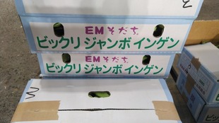
EM Sodachi® Surprising Jumbo Green Beans

【Type】

Phaseolus vulgaris L.

【Wholesale area】

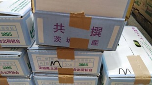
Onuki, Namegata City, Ibaraki Prefecture (Ibaraki Prefecture Kitaura Mitsuba Union Shipping Association)

【Origin of name】

Southern Mexico and Central America are said to be the place of origin. In 1654, Zen Master Ryuki INGEN brought(The ancestor of the Japanese Obaku sect; Manpukuji Temple, Kyoto)it from china (the Ming dynasty in China) to Japan and named it.

【Major features】

EM is a collection of good bacteria that are kind to both people in the natural world and the environment, such as photosynthetic bacteria that are effective in improving agricultural land and water environment, fermented lactic acid bacteria, and yeast. EM is an abbreviation of Effective Microorganisms, which means useful microbes. Developed in 1982 by Teruo HIGA, Professor Emeritus of Ryukyu University. He's a Master of Health and Nutrition with The Beijing DeTao Masters Academy (DTMA), a high-level, multi-discipline, application-oriented higher education institution in Shanghai, China.) is an abbreviation for Effective Microorganisms, which is a useful group of microorganisms. The most important factors that determine the deliciousness and nutritive value of vegetables are the density and vitality of the microorganisms working in the soil. If you compare,bread, yogurt, cheese, fermented butter. Adult taste, alcohol such as alcohol, beer and wine. Seasonings and pickles such as miso, soy sauce, mirin, and vinegar that are essential for cooking. Pickles (kimchi), tofuyo (唐芙蓉; 豆腐餻), tempeh, natto, side dish of rice.Similarly, dried bonito (鰹節), sun-dried fish, salted spicy, carassius vulgaris sushi (鮒寿司), anchovies. Black tea, Goishi tea (碁石茶: It's best known to be made (高知県長岡郡大豊町).), Oolong tea (semi-fermented tea). All of them are a combination of 80 kinds of lactic acid bacteria, yeast, photosynthetic bacteria, etc., which are useful for human health. A modern term dictionary has also appeared since 1998. EM technology, which deals with microorganisms as an aggregate, was developed long before the power of microbiota attracted worldwide attention, and has proved its ability for more than 30 years all over the world. The effect of EM technology is that complex bacteria such as lactic acid bacteria, yeast, and photosynthetic bacteria do not act directly on the target, but bring out the original power of the land (nature) by energizing indigenous microorganisms. “Ibaraki Prefecture KITAURA Mitsuba Union Shipping Association” : Established 1960 KITAURA Mitsuba Shipping Association started as a federation, number of members: 600 at the start. As of April 1, 2014, the KITAURA Mitsuba Union Shipping Association was established on September 1, 2003, when the number of employees increased to 1,300 in 1970. There are 213 union members and 17 production subcommittees. The Ibaraki Prefecture Kitaura Mitsuba Union Shipping Association, which delivers rich scents and seasonal “Mitsuba” to consumers, has been receiving the most attention for about 60 years now, delivering dreams, peace of mind, taste and scent to everyone. It is a shipping association. In January, mitsuba, perilla, raw shiitake mushrooms, kwai, spinach, and spring seven herbs. Strawberries, Mizuna green, bok choy, green siso, Raw shiitake mushrooms at the Hinamatsuri; Girl's festival in March. Bamboo shoots, irises, mitsuba, green siso, mizuna greens. Leaf ginger, shallot, perilla, spinach, kairansai at the Star Festival in July, young green onions, sweet potatoes, leaf ginger, shallot, perilla, spinach at the lantern festival in August. September, sweet potato, spinach, bok choy, green beans (beans), tomato, echalet, young onion, gobo, root mitsuba, spring chrysanthemum, raw shiitake mushrooms, mizuna, baby Chinese cabbage, Chinese broccoli, EM Kintoki sweet potato, Japanese mustard spinach. December, strawberry for Christmas, various mitsuba as New Year's supplies, bok choy, Raw Shiitake mashrooms, spring chrysanthemum, EM carrot, spinach, auction, EM Kintoki, Chinese cabbage, Chinese broccoli, EM Chijimi Spinach, EM Chijimi japanese mastered spinach. As mentioned above, the Union Shipping Association produces fresh and delicious vegetables with a sense of the seasons in four seasons with “EM Sodachi” and is pleased by consumers. Under the influence of the Kuroshio Current in Kashima Nada, it is said that there are more than 60 agricultural products produced in Namegata City, which is blessed with a relatively warm climate throughout the year. Among them, Kiri-mitsuba green and Bok Choy are the number one in the country, and green siso is the number two in the country, and the whereabouts of auction are also one of the leading production areas in the country. Features of EM Sodachi ® : Vegetables grown using EM (EM Sodachi®) are delicious. For example, bok choy has less bitterness, and overnight pickling with perilla leaves is the best taste. Leaf ginger and shallot are for sale with a spicy taste, but “EM sodachi” has a mild spicy taste. This is just an example, but if you grow it in EM, which is an aggregate of good bacteria, all the vegetables and fruits will be delicious. Furthermore, the taste of EM Kintoki (sweet potato) grown with EM technology, which is made by adding EM resuscitated sea salt (salt made by adding EM to deep sea water) to EM, and EM carrots are exceptional. Organic fertilizer is used, which is fermented by adding EM and molasses (a member of sugar) to organic materials such as rice bran, oil residue, fish residue, and crabgrass. Although the amount used varies depending on the crop, 300 to 1000 kg per 10 a; 1000 m2 is put in to grow vegetables while making soil. As a measure against pests, dilute EM with water and spray it on the foliage. In addition, the number of times pesticides are used is reduced. Since the soil is made with EM (good bacteria), the number of pathogens (bad bacteria) in the soil tends to decrease. On the other hand, as the soil changes to an antioxidant state, it is said that vegetables that are resistant to pests and have a long shelf life will grow. “Surprised jumbo common bean” : See Mikado Kyowa Co., Ltd., It is a very delicious, jumbo flat pod with no streaks, and the pods are jumbo with a width of 2 cm and a length of 20 to 25 cm. The grass is vigorous and resistant to dryness. The pods are dark green and do not bend much, and tend to be soft even when harvested as large pods. Although it is a high temperature variety, it seems to be suitable for a wide range of cultivation from warm house cultivation to open field cultivation on flat land. The leaves will also be large, so it is recommended that the distance between the plants be 45 cm or more. The pods have little bending and are soft and tasty even when they are large, and they have a sweet taste and a crispy texture that can be used in various dishes such as stir-fried foods, tempura, and seasoned foods. The main point of cultivation is to moisten the sowing floor, sow seeds and lightly sprinkle with soil. Sow 3-4 grains directly in the field at a distance of about 30 cm. Care should be taken to water the soil so that it does not dry out until germination. Leave one or two strong seedlings and thin out the others. Also, I heard that it would be good to attract the vines to stand up as they grow. Established in September 2005 by the merger of Aso Town, Tamatsukuri Town, and Kitaura Town. The city of whereabouts is located in the southeastern part of Ibaraki Prefecture, surrounded by Nishiura and Kitaura in Kasumigaura. It is an area with soil. Hitachi Province (Ibaraki Prefecture) was established by the Taika Reform of 645CE, and there are only five Fudoki in Japan that describe the situation at that time: Hitachi Province, Harima Province, Bizen Province, Bungo Province, and Izumo Province. There is already a description of the whereabouts area in. The city is a region with a warm and mild climate due to the blessings of Kasumigaura and Mt. Tsukuba. In addition, mellow land was formed from many rivers flowing into Kasumigaura. The whereabouts area is a famous place where various agricultural products can be produced regardless of the crop. The sun, water, abundant soil, and areas that have benefited a lot from nature form an industrial system centered on the agriculture, livestock and fisheries industry. As a result, many agricultural, livestock and fishery products can be shipped throughout the year, and it is possible to stably supply foodstuffs to the metropolitan area (consumption area). More than 60 kinds of various products (rice, vegetables, meat (pork, beef, chicken), chicken eggs, river fish) are stably shipped to the Tokyo area throughout the year. In particular, the items with the highest yields are sweet potatoes, potatoes, mizuna, and auction, which maintain the highest yields in Japan. “Hitachi no Kuni Fudoki (description of the culture, climate, etc. of Hitachi province; approx. 720 CE)” : Hitachi is a good country with a large country, far mountains, fertile fields, and cultivated Rangeland. Blessed with the blessings of the sea and mountains, the people are at ease and the houses are full. There is no poor man who cultivates rice fields and spins threads. You can get salt in the mountains on the left and fish in the sea on the right. In addition, Kuwahara(Mulberry field)spreads in the rear field, and hemp is cultivated in the front field. It is a place rich in the fruits of Umikawa Yamano no(海川山野之). However, since there are few high-quality paddy fields (many wetlands), seedlings may not grow if long rains continue. With just the right amount of sunshine, the grain is rich enough. On May 2; 甲子, 713; 和銅6年, Empress Genmei issued an official order to promote Fudoki to the whole country. At this time, the title “Fudoki” was not official, and it was only an order to submit the customs geography of each country together. After that, in the Heian period, Kiyotsura Miyoshi-Ko's “Twelve Articles of Opinion Sealing”, 公望 Yatabe's “Nihon Shoki Shiki”, and “Fudoki” in 925, etc. It is believed that in the Heian period, it came to be called by the generic name “Fudoki”. The official order of Fudoki is, “Write your favorite characters for the names of the counties of the seven provinces of KINAI. And record the story of the land, the reason for the name of Yamakawa Wilderness, and the old story of the old man's biography.” To make this official order easier to understand, the name of the county town is written in a favorable character (two kanji characters), a list of minerals such as silver and copper, plants, animals, fish, and insects in the county, the fertile state of the land, the place name of the mountain river wilderness. It describes the origin and the old story that the old man tells. In each country, it is probable that the survey was conducted on a county-by-county basis and submitted by each gunji; district governor (Ritsuryo period) to the Kokushi; provincial governor (under the ritsuryo system, any of a group of officials, esp. the director), who is in charge of compilation. After that, it is thought that the editing of the submitted reports of each county began based on the ideas and compilation intentions of each country, and the climate record for each country was born. Fudoki has been passed down beyond the time of 1300, and now only five countries have been told. You can see how difficult it is to pass on old records to posterity. The five traditions that have been handed down are “Hitachi”, “Harima”, “Izumo”, “Bungo”, and “Hizen” from the east. Of these five Fudoki, the only one that has been handed down in its entirety is “Izumo no Kuni Fudoki”, and the time of creation and the editor are clear. At the end of the book: 天平五年二月三十日 勘造 秋鹿郡人; アイカノコオリ 神宅臣金太理; かんやけのおみかなたり 国造帯宇郡大領外正六位上勲十二等 出雲臣広嶋とあり: It can be seen that it was created in 733 by the county priest Kanyake no Omikanatari under the supervision of Izumono Omihiroshima. There is also a theory that it is considered to be a reprint because it has been 20 years since the apology was issued. The other four Fudoki are incomplete, but are treated as valuable materials that tell the story of the time. Among them, “Hitachi no Kuni Fudoki” is the only description of the eastern country, and is used as a reference when considering the ancient eastern country. It is thought that Fudoki was created in more than 60 countries nationwide during the Nara period, but nowadays, “Izumo Kuni no Fudoki” (complete), “Hitachi no Kuni Fudoki”, “Harima no Kuni Fudoki”, “Hizen no Kuni Fudoki”, It seems that only the five Fudoki of “Bungo no Kuni Fudoki” (part) are reported. The description varies from country to country, but most of the “Hitachi no Kuni Fudoki” is written in splendid sentences with the 46 Pianwens used in Tang (China) and songs written in Man'yogana. In addition, since it is the only remaining climate record in the eastern country, it seems to be an indispensable document when considering the situation in the eastern country at that time. It is also peculiar that many Japanese Takeru appear and that there are many descriptions of gods, especially the description of Kashima District, where the great god of Kashima is enshrined. This is related to the theory that the center of compilation was Fujiwara no Umakai. 昔, 難波の長柄の豊崎の大宮に天の下知ろし食しし天皇(孝徳天皇)の御世の白雉四年に, 茨城の国造 小乙下 壬生連麿みぶのむらじまろ, そして那珂の国造: 大建: 壬生直夫子; みぶのあたひをのこらが, 坂東惣領高向大夫; ばんどうたかむこのまえつきみ, 中臣幡織田(連)大夫; なかとみのはとりだのむらじ, 達に申し出て, 茨城と那珂の郡からそれぞれ八里と七里, 合計: 十五里(七百余戸)の土地を提供して, 郡家を置いて, 『行方郡』としたらしい. A long time ago, when the emperor of Takeru was patrolled under the heavens and turned north from Kasumigaura, when he passed this country and went to Izumi Kiyoizumi in Tsukino, he cleansed his hands with Shimizu and opened a well with a ball. It was a compliment. This is called Kiyoi of Tama, and it is still in the village of whereabouts. In addition, he traveled by car to the country and offered food to God on the hills of Arahara. At that time, the emperor wanted to see all sides and said to the chamberlain. “The scenery you see while walking out of the car is that the mountain ridges and the sea coves cross each other, undulating and winding. The clouds over the peaks and the fog that sets toward the valley. They are lined up in a stunning arrangement and have a delicate beauty. That's why the name of this country is called a line-up ridge.” Hisashi Namekata later became known as Namekata. 諺に “立雨たちさめふり, 行方の国” といふ. In addition, this hill was named Arahara because it is a hill that can be seen very high from the surroundings. When I went down this hill, went out to the Omasu River, and climbed the river on a small boat, the paddle broke. Therefore, the river is called Mukajigawa River. It is a river that flows through the border between Ibaraki and Namegata. When I went up the Mukaji River to the county border, a duck was about to fly. As soon as the emperor shot the bow, the duck fell to the ground. That place is called Kamano. The soil is thin and there are no living vegetation. To the north of the field, there is a deep forest where Ichii, Kunugi, Kaede, and Japanese cypress grow densely. Masu Pond there was dug during the time of Tayu; Chief actor in a No play Takamukai. In the north, there is a shrine dedicated to the god of Katori, and the mountains beside it are fertile and densely populated with vegetation. There are sea pine trees and salt-burning algae in the sea where you can see from the ferry west of the county, but there are no rare fish and no whales. There is an old indigenous company in the east of the county, which is called the prefecture's Gion; 祇. Shimizu in the forest is called Oi, and people living nearby come to fetch water and use it for drinks. A large tree stands at the south gate of the county house. The northern branch hangs down until it reaches the ground, and then rises into the sky again. This area used to be a swamp of water, so even now, when it rains for a long time, a puddle can form in the garden of the government building. Tachibana trees are also flourishing in the nearby villages. There is Tega no Sato in the northwest of the county. A long time ago, it was named in memory of Saiki, who lived in this area and was named Tega; 手鹿. To the north of the village is a shrine dedicated to the god of Kashima. The surrounding mountains and fields are fertile and rich in chestnuts, bamboo, and chives. To the north of the village of Oga, there is a village of Nun. It was named after Saiki, who lived in this area a long time ago. The station house Umaya is now located, and it is called the Soun Station. 昔, いはれ(石村)の玉穂の宮に大八洲知ろし食しし天皇: In the reign of Emperor Keitai, there was a man named Mr. Yahazu, who cleared the valley west of the county house and the reclaimed rice field, and healed the newly reclaimed rice field. At that time, the gods of Yatsu appeared in a flock and stood on the left and right, so they could not cultivate the rice fields. (Popularly, a snake is called the god of the night sword. The shape of the body is a snake, but it has a horn on its head. , The house is destroyed and the descendants are gone. Usually, they live in groups in the field beside the county house.) Unable to see it, Mr. Matachi wore armor, took a halberd, and confronted him. Then he set up a wand to mark the moat at the entrance of the mountain, and said, “From today, I will be a priest, in order to make the mountain above here a dwelling place for gods and the village below to be a rice field where people can make. , I will honor God and celebrate the festival until the generations of my descendants, so please do not worship or resent me.” Since then, the descendants of Matachi-Ko have continued to take over this festival for generations to this day, the number of newly reclaimed rice field has increased, and more than ten towns have been reclaimed. 後に, 難波の長柄の豊崎の大宮に天の下知ろし食しし天皇: In the reign of Emperor Kotoku, Mibu no Murajimaro ruled this valley and built a pond bank. At that time, the god of the Yatsu climbed up to the vertebrate tree by the pond and did not leave easily. Maro said in a loud voice, “The purpose of building the embankment is to save the people. I don't know if it's a god of heaven or a god of nation, but please listen to the apology.” The snake ran away when he tried to say, “Knock out visible animals and fish insects without fear.” The pond is now called Shiii no Ike(Next to the old man Ikoi's house in Tamatsukuri Town Izumi). There is a vertebrate tree on the edge of the pond, and there is also a well where fresh water comes out, which was taken as the name of the pond. This is the overland station road to Kashima. Odaka no ri is located seven ri south of the county. It was named after Saiki, who used to live in this area and was named Odaka. A pond was built during the time of the Hitachi National Guard, Tagima chief actor in a No play, and it is still east of the road. In the mountains west of the pond, there are many vegetation and many indigo plants and monkeys. Whale oka, south of the pond, is a place where whales have come all the way to this point and lie down and die. To the north of the pond, there is a shrine dedicated to the god of Katori. It became the name of the pond because there was a large chestnut tree called Kuriya no Ike. In the village of Aso, hemp used to grow at the water's edge. The hemp was as thick as bamboo, and was more than one length long. Castanopsis, Chestnuts, Zelkova serrata, and Taxus cuspidata flourish, and ino and monkeys live there. Horses that live in the field are for horseback riding. In the reign of the emperor (Emperor Tenmu), who ate at the Omiya of Kiyomihara in Asuka, the life of the county's university student, Ohofu no Sato, presented the horse in this field to the imperial court. Since then, it has been called the “Missing Horse”. The horse of Ibaraki no Sato is called "Ibaraki no Sato no Horse”. Kasumi no Sato is located 20 ri(about 78.545 km ≒ To get an approximation, multiply the length value by 3.927)south of Gunya. In the old biography, Emperor Keiko, the courtier of Shimousa, when he climbed the hill of Torimi, walked slowly and looked at the country, turned to the east and said, “The blue waves in the sea. You can see this country as soon as it springs up from the red haze that flutters on the land,” said the samurai. From this time on, people came to call it “Human Township”. The shrine in the eastern mountain of the village is full of enoki, camellia, camellia, vertebrate, bamboo, salmon, and arrowheads. The island in the sea west of the village is called Niihari's island. It was named because if you stand on the island and look far north, you can see the mountains of Tsukuba in Small Tsukuba, the country of Niihari. There is a village where you want to come to Ita, located south of Kasuminosato. A station house is placed at a nearby seaside ferry, and it is called Itarai station house. To the west is a forest of celtis sinensis. This is the place where Omi, the king of Omi King, lived in the reign of Asuka Kiyomihara's emperor (Emperor Tenmu). Many salt-burning algae, sea pine, surf clams, spicy clams, and clams live in the sea. A long time ago, Takekashima Mikoto was sent to the reign of the Emperor Sujin, who ate at the Mizugaki Palace in Shiki, in order to speak to the raging thieves of the eastern country. When Mikoto set up an inn on the island of Aba, while leading the army to the thieves, he saw smoke as he looked far into the eastern ura of the sea. The soldiers suspected that this was a thief army. Mikoto looked up at the heavens and swore, “If it's the smoke of a heavenly man, come and cover me. If it's the smoke of a raging thief, go away and go to the sea.” The smoke flowed far towards the sea. Knowing that he was a thief, he ordered all the soldiers to finish breakfast early, and the army crossed the sea. Meanwhile, Kuzu, Yasakashi, Yatsukushiha, and the chief of the thieves, dug a hole, built a small castle, and lived there. When Mikoto fired his troops and expelled them, he fled to the small castle all at once, closing the gate tightly and standing up. Immediately make a plan, select brave soldiers to hide in the depressions of the mountain, build weapons and arrange them in the beach, line up boats, knit rafts, flip the caps of clothing with clouds, and rainbow the flags. Ama no Torikoto and Ama no Torifue sang and danced the first song on Kishima Island for the first time in seven days and seven nights, and enjoyed playing with the sound of the waves. Hearing this fun song and dance, the thieves came out with their families and men and women, and flocked to the beach and laughed happily. Mikoto had his cavalry block the castle, attacking thieves from behind, capturing them, and setting them on fire to destroy them. The place where I said painfully was the town of Taku (Itarai) now, the place where I said that I would slash normally was the village of Futsuna, and the place where I said that I would slash cheaply was the village of Yasukiri, and I often slash. That is Esaki's eup. In the sea south of Itarai, there is a shore of about 34 ri; about 132 km. In the spring, men and women come from Kashima and whereabouts to pick up clams, surf clams and various other shellfish. Tohoku no native place is located 15 ri(about 58.909 km)to the northeast of the county. A long time ago, when I visited this town during the procession of the Emperor Takeru, Torihi Torihiko, whose name was Saeki, rebelled against his life and defeated him. He then headed for Yagatano's Book Palace, but the road was narrow, rugged (rough), and rough, hence the name Toma. The soil in the field is thin, but purple grows. There are also two companies, Katori and Kashima. In the surrounding mountains, there are forests of wild boars, hahaso, chestnuts, and shiba, and many wild boars, monkeys, and wolves live there. To the south of Toma, there is the art capital, Kitsunosato. A long time ago, there were two Kuzu, Kitsuhiko and Kitsuhime. In front of the emperor's pilgrimage, the princess turned against Mikoto, disobeyed herself, and behaved in a very rude manner, so she was killed with a sword. The princess was terrified and fell down on the side of the road with a white flag, and welcomed the emperor. The emperor mercifully gave her grace and forgave her house. As she goes further on her ride and goes to Onukino's palace, she takes her sister with her, and she does her true heart on rainy and windy days. I finished it in the morning and evening. The emperor was delighted with his lonely appearance, and his love became a stain, so he called this field Uruhashi Ono no. There is a rice field village to the south of the art capital village. In the reign of Empress Jingu, a person named Kotsuhikoto was sent to Korea three times. It became the name because it was given a rice field for its achievements. The field of Hazumuno no was named after Yuhazu was built in the temporary palace of the emperor of Takeru. There is a branch of the god of Kashima on the seaside north of the field. The soil is thin, and elms, elms, elms, bamboo, etc. are sparsely grown. There are Auka and Oho villages to the south of the rice field village. A long time ago, when the emperor of Takeru stayed at Kazakinomiya in front of the hill of Auka, he built Ohido no on the urabe and connected small boats to go to Gozaisho as a bridge. He named Ohohikara, Oho. Also, Ohotachibana no Mikoto, who was after the emperor of Takeru, came down from Yamato and met the emperor here, so it is called Afuka's eup. Tanakiyonoi : According to the whereabouts of “Hitachi no kuni Fudoki”, “Hunting under the heavens of Emperor Yamato Takeru and conquering the north of the sea. Fortunately, he faced the water, washed his hands, and prospered the well with balls. He is still in the village of whereabouts and is called Tamakiyoi.” Even though it is a well, it is now like a pond in a garden. According to the monument of “Tamakiyoi” by Tsutomu KURITA, which stands nearby, it is said that it was dug by the villagers during the famine of Tenmei. Contents of Hitachi no Kuni Fudoki, Namegata District-A long time ago, when the emperor of Takeru was patrolled under the heavens and turned north from Kasumigaura, when he passed this country and went out to Shimizu in Tsukino, he cleansed his hands with Shimizu and opened a well with a ball. It was a compliment. This is called Kiyoi of Tama, and it is still in the village of Namegata. 鹿行文化研究所(旧行方郡玉造町甲)1996 “小貫館跡発掘調査報告書” : 小貫館跡遺跡(旧行方郡玉造町西蓮寺字寺前): 墓地造成工事に伴う発掘調査, 城館, 中世 (細分不明) 時代, 井戸, 建屋跡2, 縄文時代の石器, 陶磁器, 鉄滓, 古銭, 人骨, 五輪, 塔水輪. Manjuin Sairenji Temple of the Tendai sect is an ancient temple that is said to have been built in 782 and has many cultural assets. The temple gate guarded by fierce Deva Kings was built in 1543 and was originally built as a tower gate. In 1790, it was rebuilt into a mountain gate and then changed to the temple gate guarded by fierce Deva Kings. The principal image is Yakushi Nyorai, and it is commonly recognized as Mt. Koya in Hitachi. The gate and Sorinto(August 29, 1950)are designated as national important cultural properties, and the wooden Yakushi Nyorai(March 12, 1958)sitting statue is designated as a tangible cultural property designated by Ibaraki Prefecture. Only the first floor of the Sanken Ikko tower gate is left, and it is said that the shape of Kaerumata and Minotsuka is peculiar and you can see the local color peculiar to the end of the Muromachi period.


Photo_21-08-11-07-03-17.948~2.jpg

Jumbo green beans are excellent agricultural products with flat and soft pods, streaky green beans, 2 cm wide and 20-25 cm long. The pods are characterized by little bending and are soft and tasty even when they are large. In addition, it has a sweet and crispy texture and can be used for various dishes such as stir-fried foods, tempura, and vegetable with dressing.


Photo_21-08-11-07-03-19.681.jpg

It seems that the biggest factors that determine the deliciousness and nutritional value of vegetables are the density of microorganisms working in the soil and the principle of vitality. It is. The cultivation method of "EM Sodachi ®" is to use organic fertilizer fermented by adding EM and molasses (a member of sugar) to organic materials such as rice dregs, oil dregs, fish dregs, and crab shell (often ground or crushed and used as fertilizer). The amount used varies depending on the crop, but it seems that vegetables are grown while making soil by putting 300 to 1000 kg per 10a. As a measure against pests, it seems that EM is diluted with water and sprayed on the foliage.


Photo_21-08-11-07-03-33.288.jpg

Features of EM Sodachi ®: The number of times pesticides are used is reduced. Since the soil is made with EM (good bacteria), it seems that the number of pathogens (bad bacteria) in the soil will decrease. On the other hand, because the soil changes to an antioxidant state, it is resistant to pests and grows long-lasting vegetables, so Ingen is also delicious.

Thursday, April 18, 2024

Keigetsu OMACHI: The song sings the true heart-Shuntei TOYABE and the Sun: With your own will What is consistent throughout life A person who has a permanent life-Oirase Gorge: The flow of about 14 km from Lake Towada / Konoguchi to Yakeyama: Kyoka, Suzu IZUMI (Onna Keizu published in 1907 (published by Shunyodou in 1908), model of Yanagibashi geisha Tsutakichi, Yushima's white Japanese apricot) married couple

From Towada Chamber of Commerce and Industry: The Towada Chamber of Commerce and Industry has entered into an agreement with the Towada Barayaki Seminar, a civic group that works to revitalize the town through food, for the exclusive use of the trademark Towada Belly Meat Yaki, and manages the use of the trademark and the brand. A dish made of beef belly and a large amount of onions, seasoned with a sweet and spicy soy sauce, and then grilled on a griddle. There are also grilled pork belly and horse belly. It is said to have originated at a food stall in front of the Misawa US military base about 50 years ago, and it spread to Towada City, which is in the same cultural area, and is now loved by the citizens of Towada and has become a soul food.

【Product name】

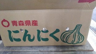
White garlic

【Type】

Allium sativum L.

【Producing area】

Towada City, Misawa City, Kamikita District, Sannohe District, Aomori Prefecture (Towada Katsuai Ichiba; Towada Seika Co., Ltd.)

【Origin of name】

The oldest encyclopedia in Japan, “Wamyō Ruijushō,” compiled in the middle of the Heian period, has the description “蒜; ail.” It was in the early Muromachi period that it came to be called “Garlic”. It is said that the etymology is “忍辱; forbearance (in the face of difficulty, persecution, etc.)” in Buddhism, which hates odors. From pure white and beautiful garlic on the epidermis.(Because it is a fruit of pure white color like snow that accumulates in Fukuchi Village, Sannohe District, Aomori Prefecture (Currently Fukuchi Area(It was an inland village adjacent to the western part of Hachinohe City, but disappeared because it merged with Nagawa Town and Nanbu Town on January 1, 2006 and became a new Nanbu Town.), Nanbu Town, Sannohe District) of origin-Famous as Fukuchi White Six Pieces.)

【Major features】

December 2021, Prefectural Sanbongi Agricultural High School in Towada City, Aomori Prefecture (Ministry of Education, Culture, Sports, Science and Technology designated agricultural manager training high school: Only one general education. Focusing on activities that make use of learning, such as learning, finding and solving local problems, we are aiming for a one-of-a-kind general course that is not found in other schools. In addition to raising animals, we have created an environment where you can learn a wide range of things such as the environment that supports production, civil engineering, processing and distribution of agricultural products, and we are continuing to promote education aimed at professionals in each field. Through various events and club activities, the students' own hands Foster a wealth of human resources to achieve one thing while collaborating with colleagues. Large-scale farms, dormitory education, agricultural clubs will continue to be enhanced, and general departments will also participate as needed. We are promoting education that maximizes the merits of agricultural high schools.) In Aomori Prefecture, a boy student who was practicing cattle breeding was found to have collapsed unconsciously in the barn. Seems to have decided to set up an accident investigation committee to verify the guidance situation at the school. This was revealed at a press conference by the Aomori Prefectural Board of Education on June 20, 2022. In December 2021, a 17-year-old boy who was practicing agriculture in the barn of Towada Prefectural Sanbongi Agricultural High School was found with blood bleeding from his head and was taken to the hospital, but he is still conscious. It is the contents. On June 28, the prefectural board of education set up an accident investigation committee consisting of six people, including lawyers and academic experts, saying that it was necessary to confirm that the faculty members and schools who were instructing at that time had not made any mistakes regarding this accident. It has been clarified that the first meeting will be held. It seems that the committee will proceed with the verification based on the accident reports submitted by the school so far. Towada Fruit and Vegetables Co., Ltd. is composed of 2 cities and 8 towns, including Misawa City, Kamikita District, and Sannohe District (partly), centering on Towada City, and occupies almost the upper 13 areas in the south of the prefecture. “Towada City”, A beautiful town where rich nature and art are fused, such as Lake Towada, Oirase Gorge, and Hakkoda, which are woven by the four seasons and emotions, and the government office street, which is centered around the Towada Art Center. By making the most of the diverse local resources that we have carefully inherited from our predecessors and the wisdom of the citizens living in this town, and working together, more people will “want to live” and “continue to live.” We will promote community development that is strongly supported by want and want to visit, and create an ideal hometown full of hope for the future that can be passed on to children who will lead the next generation with strong pride and confidence. I will continue. It is located in the center of the southern part of the prefecture and has an area of 688.60 km2 due to the merger. The population is gradually increasing from the latter half of the Showa era to the Heisei era, and it seems that the local environment is comfortable to live in. However, it decreased temporarily in 1990 and 1999. However, it seems that there is an increasing trend now. It is formed from areas with abundant natural environments such as Mt. Hakkoda and Lake Towada, and areas with rural and urban functions, which are deeply rooted in the areas I introduced earlier. There are Hachinohe City and Misawa City within a 20 km radius of the city, and Hachinohe City in particular is a major rival city for expanding the commercial area of Towada City. I also heard that in recent years, the suburbs of Shimoda Town have had a great influence on maintaining Towada's trade area since inviting a large shopping center. From here, I heard from my relatives, but there are concerns about local residents and local business and industry associations. As in many local cities in recent years, it seems that the central city area is becoming donuts and sprawl against the backdrop of population outflow to suburbs, declining birthrate and aging population due to the progress of motorization and lifestyle changes. Moreover, in recent years, due to the diversification of consumer needs and the widening of the range of purchasing trends due to the development of the automobile society, the outflow of customers to large stores in the suburbs of the city and large shopping centers in the Shimoda Town and Hachinohe city areas Both the trade area population and the absorption rate population have shown a significant decrease or decline. As a result, the number of retail and commercial stores in the central block has decreased, the number of vacant stores and vacant lots has increased, the retail commercial activities and attractiveness of the central city as the face of the city have declined significantly, and the decline of the central city has been accelerating. Local residents and the government are worried about such changes in the situation, and based on the Central City Invigoration Law, formulated the “Towada City Central City Invigoration Basic Plan” in August 2020. In this basic plan, based on the results of the workshops of citizens and merchants, the direction of future town development and specific items to be examined are summarized. For more information, please contact the website, government office, or parliamentary secretariat for an easy-to-understand explanation. The city was pioneered in 1859 by Tsuto NITOBE(Famous as the grandfather of Inazo NITOBE, the portrait of the previous 5000-yen bill. At the start of the business, old man was already 62 years old, and it was a challenge after the average life expectancy at that time was far beyond his 50s. At that time, farmers suffered from repeated bad harvests and famines, and migrant workers and escapes continued. Therefore, in order to stabilize rice production and save the lives of farmers, old man planned to draw water from the Oirase River and develop a 2,500 ha paddy field on the barren Sanbongihara Plateau. In addition to the investment from the clan, many investors were solicited for the funds, and the private property of the den was also used. After the introduction of advanced civil engineering technology and the labor of many farmers, after difficult construction such as tunnel construction through hard rock, it took about four years to successfully draw water into the barren wilderness. The completion of this waterway brought rice harvests to the area for the first time in the fall of 1860, and when the lord of the Morioka domain, Toshihisa, visited the waterway, the waterway was named Inaoi River. After that, the reclamation project was handed down to the local people, the waterway reached the Pacific coast, and the total length including the tributaries was 70 km. Today, it moisturizes about 5,900 ha of paddy fields and is popular with local citizens as a waterside for relaxation. In the city, there is the Nitobe Memorial Museum(BUSHIDO - 東三番町), a museum facility whose predecessor is the Nitobe Bunko, a privately-owned company founded by Inazo NITOBE, who is famous as an international representative of Japan.) and others. Located in the central part of the green Sanbongihara plateau(It used to be a wilderness called “Sanbongi” because there are only three trees.)at the foot of magnificent mountain Hakkoda in the southeastern part of the prefecture, it is known as the eastern entrance of the national park “Lake Towada”. In addition, the southern region has produced many famous horses since the Heian and Kamakura periods, and the city has been busy with horse auctions since the horse market was held in 1863 during the feudal era. Later, the War Horse Replenishment Department was also established, and it was widely known as a horse-producing area. 国指定文化財 : 重要文化財(建造物), 旧笠石家住宅, 昭和48年2月23日, 大字奥瀬字栃久保, 特別名勝及び天然記念物 : 十和田湖および奥入瀬渓流, 昭和27年3月29日, 十和田市, 秋田県小坂町, 天然記念物 : 法量のイチョウ, 大正15年10月20日, 大字法量字, 銀杏木, 国登録有形文化財 : 建造物, カトリック十和田教会, 平成27年8月4日, 稲生町, 県指定文化財 : 無形民俗文化財, 南部切田神楽(南部切田神楽会), 昭和31年5月14日, 大字切田, 国の記録作成等の措置を講ずべき無形の民俗文化財, 平成16年2月6日(選択), 無形民俗文化財南部駒踊(洞内南部駒踊保存会), 昭和34年10月6日, 大字洞内, 国の記録作成等の措置を講ずべき無形の民俗文化財, 昭和49年12月4日(選択), 史跡 : 一里塚(一対二基), 昭和36年10月6日, 大字伝法寺字平窪, 史跡 : 一里塚(一対二基), 昭和36年10月6日, 大字大沢田字池ノ平, 天然記念物 : モミの木, 昭和47年12月6日, 大字沢田字水尻山, 市指定文化財 : 有形文化財, 彫刻, 法心和尚像, 昭和40年3月30日, 大字洞内字前田, 彫刻 : 道無和尚像, 昭和40年3月30日, 大字洞内字前田, 彫刻 : 伽羅聖観世音菩薩像, 昭和40年3月30日, 大字洞内字前田, 史跡 : 法心塚, 昭和40年3月30日, 大字洞内字沼田野古文書新山神社の記録及び修験道の古記録類, 昭和43年4月3日, 大字赤沼字下平, 史跡 : 一里塚, 昭和55年1月31日, 大字相坂字白上, 古文書 : 新渡戸記念館収蔵品及び新渡戸家文書, 昭和56年4月24日, 東三番町, 史跡 : 板石塔婆, 平成2年8月23日, 大字大不動字, 柏木古文書六十六部日本廻国巡礼納経札, 平成2年8月23日, 大字伝法寺字平窪, 史跡 : 山神の石碑, 平成2年8月23日, 大字三本木字倉出, 史跡 : 金毘羅山の石碑, 平成2年8月23日, 大字三本木字倉出絵図寛文三本木村絵図, 平成10年6月19日, 元町西一丁目, 歴史資料 : 三本木原実測図, 平成11年8月23日, 東二十一番町, 史跡 : 日本廻国納経供養塔, 平成26年11月28日, 大字深持, 古文書 : 廻国奉納経帳, 平成26年11月28日, 大字奥瀬, 無形文化財 : 民俗芸能, 南部駒踊(南部駒踊米田保存会), 昭和40年10月8日, 大字米田, 民俗芸能 : 南部駒踊(南部駒踊滝沢保存会), 昭和40年10月8日, 大字滝沢, 民俗芸能 : 南部駒踊(南部駒踊立崎保存会), 昭和40年10月8日, 大字立崎, 民俗芸能 : 藤島獅子舞(藤島獅子舞保存会), 昭和46年12月13日, 大字藤島, 民俗芸能 : 南部駒踊(南部駒踊相坂若駒会), 昭和46年12月13日, 大字相坂, 民俗芸能 : 南部洞内神楽(洞内南部神楽保存会), 昭和55年1月31日, 大字洞内, 民俗芸能 : 沢田鶏舞(沢田鶏舞保存会), 平成5年7月5日, 大字沢田, 民俗芸能 : 三日市神楽(三日市神楽保存会), 平成5年7月5日, 大字沢田, 民俗芸能 : 六日町鶏舞(六日町鶏舞保存会), 平成7年3月22日, 大字相坂, 民俗芸能 : 南部駒踊(南部駒踊上舘保存会), 平成7年3月22日, 大字切田, 民俗芸能 : 晴山獅子舞(晴山獅子舞保存会), 平成16年10月19日, 大字深持民俗芸能 : 南部深持神楽(南部深持神楽保存会), 平成16年10月19日, 大字深持, 民俗芸能 : 大不動鶏舞(大不動鶏舞保存会), 平成16年10月19日, 大字大不動, 民俗慣習 : 板ノ沢のカヤ人形作り, 平成26年11月28日, 大字深持, 天然記念物 : いちょう, 昭和55年1月31日, 大字大不動字八幡, 天然記念物 : 赤松, 昭和56年4月24日, 大字大不動字柏木. “Misawa City”, Aomori Prefecture is a treasure trove of Jomon culture, and many archaeological sites have been discovered in the city. The Noguchi shell mound and Waseda shell mound around Lake Ogawara are particularly famous, and the pottery from the late Jomon period excavated from Noguchi is said to be as elaborate as the Kamegaoka site in Kizukuri Town, Nishitsugaru District, and is a valuable research material. The Misawa City Museum of History and Folklore has a large collection of a wide range of historical materials such as these archaeological materials, fishing gear, kagura masks of folk performing arts, and ancient documents. In addition, rare animal and plant specimens of Lake Ogawara are also exhibited, and it is a mysterious place where you can experience the traditional life and environment in this place rich in nature. During the feudal era, the largest ranch “Kizaki no Maki” of the Nanbu Morioka domain was spread, and even after the Meiji era, it was taken over by the Sabishirotai shared ranch and the village ranch, and has long been widely known as a horse-producing area. Even now, in the suburbs, you can still see the scenery of horses and cows grazing, and you can remember those days. 淋代平; Miss Veedol: 1931 Mr. Herndon and Mr. Pangbourne's starting point for a non-landing transpacific flight. In addition, the population of Misawa Airport (base), which was built by the Japanese Navy before the Pacific War, has increased sharply due to the requisition and expansion of the US military after the war. It has developed as a city full of exoticism. As a city with a reserve of Jomon archaeological sites, a vast ranch site, an airport, and a fishing port built on a sandy beach, which is rare in Japan, the city will continue to have a diverse face and history with local residents. Due to the cool climate, rare alpine plants such as Buckbean, Daylily, and Drosera rotundifolia L. can be seen even on flat ground. Surrounded by the Pacific Ocean in the east and Lake Ogawara in the west, it has a varied natural environment such as forests, plateaus, grasslands, paddy fields, tidal flats, lakes and coasts. The Phragmites australis grassland, which stretches about 20 minutes north of the city center by car, is a treasure trove of nature and a wetland registered under the Ramsar Convention, Hotoke Swamp. The registration date is November 8, 2005, and it is famous as a low-rise marsh: Nationally Designated Buddhist Wildlife Sanctuary Buddhist Swamp Special Protection Area. Located in the north, a grassland wetland between the Pacific Ocean on the east and Lake Ogawara on the west. Due to the cold winds of the easterly wind “Yamase” from spring to summer and the monsoon “Hakkoda grated” from autumn to winter, this area is flat but has alpine plant communities and both the southern and northern limits. Animals and plants can be seen. In addition, it plays a major role as a breeding ground for rare birds such as the Japanese Marsh Warbler and Ochre-rumped bunting, which are designated as endangered species, as well as a landing site for migratory birds such as waterfowl. Rare wild birds such as the Yellow rail and the Japanese endangered Eastern marsh harrier inhabit, such as cancers, ducks, yellow rails, and dianthus superbus L. You can also see wildflowers such as var. Superbus, Achillea alpina subsp. Japonica, and Scutellaria strigillosa var. Yezoensis, which are visited by many people who enjoy nature. The city is known as a good point for surfing, with its Pacific coastal waves and sandy beaches. Around Lake Ogawara, a citizen's forest park has been developed, where you can enjoy your leisure time with the blue sky and lush nature, and your feelings will be refreshed. There are auto campsites and bungalows on the shores of the lake where the gentle waves come, and when you walk along the promenade that goes around, you can hear the birds singing in the clear air. At baseball stadiums and tennis courts, you can sweat refreshingly and wash your feelings. What comes to my mind is the 51st National High School Baseball Championship Final, in which Aomori Prefectural Misawa High School participated and won, and on August 18, 1969, the moving game and suspicion judgment from the next day. Regarding suspicions, the rules do not stipulate the relationship between the university of origin and seniors and juniors. It's all about this. No matter how the times pass, everyone has a feeling. Indeed, it connects with the present age. The first decision is to clear the suspicion, but it cannot be established without each reason. I think that if you don't always break through, you can't move on. In addition, hot spring excavation is actively carried out in the city, and in addition to the municipal hot spring (Yasuragi 荘) in the citizen's forest, there are hot spring public baths in various parts of the city. Misawa City is located in the southeastern part of Aomori Prefecture, facing the Pacific Ocean to the east and Lake Ogawara to the west. It is a flat land with an area of about 120 km2, about 11 km east-west, about 25 km north-south. Located in the southern part of the prefecture, which has prospered as a horse-producing area since ancient times, the city area was included in the “Kizaki no Maki(Horse pasture directly managed by the Southern Clan)” of the feudal ranch during the Edo period, and people were involved in horse-producing and fishing. It became the US military Misawa base and has undergone a major transformation. Today, as a city in the sky with one of the leading aviation facilities in Japan, many US military personnel, civilian employees and their families live in it, and it continues to develop independently as an international city with an exotic atmosphere. Sister city exchange with Wenatchee and East Wenatchee in Washington, USA, triggered by Miss Veedol, the world's first non-landing crossing of the Pacific Ocean: Many illustrious events such as American Day, International Summer Festival, and Misawa Air Base Festival are also held. The nature, history and culture of the city, each with its own rich expression. “Aomori Prefectural Misawa Aviation & Science Museum” that tells the deep relationship with the sky, “International Exchange Education Center”, a base facility for international exchange: “Roadside Station Misawa Tonami Clan Memorial Tourist Village” that introduces Mr. Yasuto HIROSAWA (Place of birth: Aizuwakamatsu City), who opened a modern Western-style ranch, and sells special products of the city: Furthermore, it is a wonderful place where you can experience the international cultural city, such as the “Shuji TERAYAMA Memorial Hall” that introduces the unique world of the genius Mr. Shuji TERAYAMA(あゝ、荒野, ひとりぼっちのあなたに, 天井桟敷; 身毒丸). City area 119.87 km2, latitude 40 degrees 40 minutes north, longitude 141 degrees 22 minutes east. It is known that winter is a northern country, but the amount of snowfall is small, and there are many sunny days due to the monsoon that blows from the northwest. Due to the influence of the easterly wind (Yamase) that blows from spring to summer, the coastal area is often covered with cold air and thick fog, and it can be seen that the end of the rainy season is late and summer is short. In the land rich in nature, burdock, dioscorea opposita, garlic, etc., which are one of the highest quality in Japan, are produced, and poultry farming and pig farming are also actively carried out and gaining popularity. As for marine products, good quality squid and smelt are caught in the Pacific Ocean, and clams and smelt tend to be caught in Lake Ogawara. The catch of squid produced in the prefecture is the highest in Japan. Among them, the Japanese Common squid from Misawa is nicknamed “Red Dragonfly” because it is caught in the daytime under strict quality control and displayed in the central market and supermarkets in the metropolitan area the next morning. It is popular and has excellent taste and freshness, and is highly evaluated by consumers and related parties. Japanese Common Squid is registered as a regional collective trademark endorsed by the Japan Patent Office on June 3, 3rd year of Reiwa under the name of “Misawa noon squid”. As a proof of its quality, the Styrofoam squid box has a sticker of “Misawa noon squid” with an illustration of Miss Veedol (Red airplane). At restaurants in the city, sliced raw fish is also cooked alive. Yamazaki Pork is a Misawa brand that focuses on quality, food, and the environment. Pigs raised in a highly hygienic environment are safe and secure. In addition, it contains about 7 times as much C29H50O2 as ordinary pigs due to carefully selected pure vegetable feed given at the final finishing stage, and has a light fat and soft meat without odor. 三沢市教育委員会(さくら町)1989 “三沢市遺跡詳細分布調査報告書” 三沢市埋蔵文化財調査報告書6 : 風穴遺跡 : 公園建設のための試掘調査, 集落, 縄文, 土坑1, 柱穴状ピット3, 土器, 石器, 土製品, Both the remains and the relics are considered to be around the time of the 10 large trees in the middle of the Jomon period. A slightly elevated earthwork-like rise with wide flats has an inclusion layer and remains and appears to surround the depression. Confirmed that the area outside the range was included, and expanded the range - 縄文中期末葉. 小田内沼遺跡 : 散布地, 縄文時代, 土坑2, 柱穴状ピット11, 土器, 石器, Both the remains and the relics are thought to be from the early Jomon period. Confirmed that the area outside the range was included, and expanded the range. 春日台遺跡 : It was confirmed that 67 new buried cultural property inclusion sites and 14 well-known archaeological sites had expanded the range of conventional inclusion areas. 岡三沢神楽保存会 : It was handed down to the Nonomiya family, a descendant of the old Shugendo sect. In July 2010, it was designated as a prefectural intangible folk cultural property. 浜三沢神楽保存会 : The year after the cholera epidemic of 1943, villagers who prayed for health and safety by dispelling evil spirits learned the Kagura that is handed down in Kirida, Towada City. In April 1973, Gongen dance was designated as a city intangible folk cultural property. 塩釜神楽保存会 : Many migrants from different origins in Shiogama are said to have introduced Kagura in order to unite the village. In April 1973, “Chicken Dance” was designated as a city intangible folk cultural property. 根井神楽保存会 : Kagura is called a lion dance and was performed during the New Year and the First Full Moon Festival. There are many Kagura books left since 1879. In April 1973, “Yamanokami” was designated as a city intangible folk cultural property. 織笠神楽保存会 : It is said that the Inari Shrine was built in 1884 and danced Kagura every year on October 15th of the lunar calendar. Tsutawaldoboku says that it is a system of Hachinohe Kagura, which is rare in Misawa. In April 1973, “Kagura Dance” was designated as a city intangible folk cultural property. 岡三沢鹿子踊保存会 : Based on a set of four heads, it is performed by a total of thirteen Kago. The form of the dance begins with forming a circle and putting the deer in the garden, and the dance changes every lap, such as the fawn herder, and consists of 13 seats. In February 1993, “Kago dance” was designated as a city intangible folk cultural property. 浜三沢駒踊保存会 : At the vast ranch "Kizaki no Maki" directly managed by the Nanbu feudal clan, the traditional dance that has been handed down from ancestors is continued with a dance that is an entertainment of releasing horses and catching horses in the fall. In October 1959, “Hama Misawa Nanbu Koma Dance” was designated as a prefectural intangible folk cultural property. Yamanaka Shinto music preservation society : It is said that a person from Esashika Village, Kunohe District, Iwate Prefecture reported this. The performances are four songs, “Chicken Dance, Gongen Dance, Bon Odori, and Sanbaso”. Of these, Chicken Dance was designated as a city intangible folk cultural property in February 1994. Fruitful year Dance Preservation Society : It has been danced for about 200 years, but in recent years it has been restored from the memory of the old man, and it is said that it has been performed at the Misawa Elementary School 100th Anniversary Festival. In February 1994, “Honen Dance” was designated as a city intangible folk cultural property. “Rokunohe Town, Kamikita District”, The place name does not refer to the village, but when Mr. Fujiwara of Hiraizumi was defeated in the Kamakura period, Mitsuyuki NANBU received Nukanobu five counties (southern Aomori prefecture and northern Iwate prefecture) from Minamoto no Yoritomo due to the great achievement of conquest. There is a theory that it was divided into Kukanobushikado no System to train war horses and one place was set up in one door, and that it was added as a logistics base before that due to strategic reasons. In any case, the Oirase River basin area was called “Rokunohe”. During the feudal era, it was under the control of the southern (Morioka) domain and was under the jurisdiction of Gonohe Daikan. After that, it belonged to the Shichinohe domain, and was unified into Shichinohe prefecture, then Hirosaki prefecture, and Aomori prefecture in October by the abolition of the domain in 1871. With the enforcement, seven villages, Orimo Village, Yanagimachi Village, Kodaira Village, Tsurubami Village, Inu Ochise Village, Kamiyoshida Village, and Shimoyoshida Village, merged into Rokunohe Village. After that, it was changed to Rokunohe Town in October 1957, and in October 2017, it celebrated the 60th anniversary of the enforcement of the town system and continues to the present day. Located in the southeastern part of Kamikita District, it is adjacent to Oirase Town in the east, Towada City in the west, Gonohe Town in Sannohe District in the south, and Misawa City and Tohoku Town in the north. Area 83.89 km2, location is 141 degrees 20 minutes east longitude, 40 degrees 36 minutes north latitude distance 10 km east-west 15 km north-south height 89 m above sea level 14 m low. It consists of the diluvial land that forms part of the southern Daigatake area and the elongated diluvial plain, and there are no conspicuous highlands or mountains. The main water system is the Oirase River, which originates from Lake Towada and flows from east to west slightly south of the center of the town, and the paddy fields spread out in the basin and the scenery is clear. Although it is located in the North Tohoku region, it has relatively little snow and is comfortable to spend in a mild climate throughout the year. However, in the summer, a cold wind called Yamase blows from the Pacific Ocean side, which may affect the growth of crops. The population of the town peaks in 1960 and follows a gradual declining trend. This is thought to be due to the fact that the number of births has declined, the outflow to urban areas has progressed due to the booming economy over the past few times, and that the outflow has reduced the working-age population as well as the young population. During this period, the population was temporarily increasing from 1980 to 1985 due to the completion of Komatsugaoka New Town. However, in recent years, due to the effects of child-rearing support policies and settlement promotion policies, the population has increased in FY2012. 青森県埋蔵文化財調査センター(青森市大字新城字天田内)2007 “坪毛沢(1)遺跡 / 坪毛沢(3)遺跡” 青森県埋蔵文化財調査報告書430 : 坪毛沢遺跡 : 上北郡六戸町大字犬落瀬字坪毛沢地内, 東北新幹線建設事業, 散布地, 縄文時代, 溝状土坑18, 縄文土器, 石器, Detects pitfalls made on hillsides. Towada a Detects dwelling traces before volcanic ash fall. 狩場, 集落, 平安時代, 竪穴建物2, 溝1, 土師器, 須恵器, 鉄製品, 土製品. 坪毛沢(3)遺跡 : 上北郡六戸町大字犬落瀬字坪毛沢地内, 散布地, 縄文時代, 土坑10, 溝状土坑34, 縄文土器, 石器, A part of the Heian Period settlement and grave area was detected. It is possible that iron and copper were produced from the excavated relics, with the majority of the remains before the Towada a volcanic ash and before the Mt. Baekdu ash fall - 狩場種別, 散布地, 弥生時代, 包含地, 集落, 平安時代, 竪穴建物15, 土坑28, 掘立柱建物1, 性格不明遺構3, 土師器, 須恵器, 羽口, 鉄製品, 鉄滓, 銅滓, 溝2, 焼土2, 硬化面1. “Nanbu Town, Sannohe District”, A historical town that has developed since ancient times as the birthplace of the Southern Clan, as if to leave an impression on its name. It is uncertain when the medieval Nanbu clan joined Oshu, starting with the first Nanboku Mitsuyuki (Jusani (Junior Third Rank)), but it is certain that he had joined Oshu from the end of the Kamakura period to the beginning of the Northern and Southern Dynasties. In the Muromachi period, Mr. Nanbu Sannohe ruled the Nukanobu district centering on the Seijujikan in the current Nanbu town, and from the latter half of the Muromachi period to the Warring States period, he expanded his influence to Tsugaru, central Iwate prefecture, and Kazuno region in Akita prefecture. It was from the 13th generation Moriyuki that the achievements of Mr. Nanbu Sannohe were confirmed by the historical documents of the literature, and he was appointed as the “Kyoto Fuchishu” under the direct control of the Muromachi Shogunate, and was proud of one of the most prestigious in Oshu along with Mr. Date and Kasai. In 1418, he presented Horse hundred silk by the roll and 1,000-ryo (a monetary unit at that time)to Yoshimochi, the fourth shogun of the Muromachi Shogunate. During the Warring States period, he expanded his power when he was in his 20s, Masayasu 22s, Yasunobu 23s, and Harumasa 24s, and took control of northern Mutsu. Castles of this period remain in various places in the town, and Mr. Kita(奥南旧指録)lived in Kenyoshi Castle and Mr. Higashi(改正諸家系譜, 参考諸家系図)lived in Kaminakui Castle to strengthen the defense. The Seijujikan is said to have been burned down by the arson of his vassal Btsuchu Akanuma in 1539, and a large amount of carbide has been confirmed from the castle as well as the heated ceramics of that period. Valuable gold leaf pottery and high-class ceramics that symbolize the authority of the Nanbu clan at that time and the exchange with the capital have been excavated from the building. It is said that the pottery was excavated only from the site of the Seijujikan in the Tohoku region. From the Warring States period to the Azuchi Momoyama period, Mr. Nanbu Sannohe moved from Seijujikan (Nanbu Town) to Sannohe Castle (Sannohe Town) and then to Fukuoka Castle (Ninohe City) due to the expansion of the territory to the south, and finally Morioka Castle. (Morioka City) was built and used as a residence. Even in the Edo period, Nanbu Town was recognized as an important land for ancestors. In the precincts of Sankoji Temple(Myoshinji School of the Rinzai Sect), which is adjacent to the Seijujikan, there are the tombstones of Mr. and Mrs. Nobunao 26th (a cultural property designated by the town), the first feudal lord of the Morioka Domain (27th), Toshiyasu mausoleum (prefectural treasure), and Toshinao 27th. Toshinao Mausoleum (National Important Cultural Property) was erected. It is located in the southeastern part of the prefecture and is adjacent to the western part of Hachinohe City, which has the second largest population in the prefecture. The coastal area of the Mabechi River, which runs through the center of the town, has a strip of plains, making it a sober and fertile soil. In the southwestern part of the town, you can see Mt. Nakui at an altitude of 615 m, and the mountains and rivers, and the basin are blessed with abundant nature with a rural landscape. April 1, 1889: Municipal system enforced. April 1, 1955: Jibiki Village and Tabe Village merge to form “Fukuchi Village.” “Takko Town”, the southernmost town in the prefecture, is a major garlic producing area, and has been one of the first in the prefecture to work on the formation of a garlic producing area. Takko garlic is a large ball with one large piece that bears fruit well, and is a six-piece type called “Fukuchi White” that boasts snow-whiteness and good quality. Thorough quality control by establishing cultivation standards and shipping standards. In 2006, it was registered as the first regional collective trademark in Tohoku. Kizaki, Oirase Town, Kamikita District, Aomori Prefecture, Within Kizaki SME Cooperative; Co-op Aomori Prefecture Black Garlic Association: The “Regional Collective Trademark Registration” filed with the Japan Patent Office on September 6, 2014 for the purpose of branding black garlic was registered on July 10, 2015. Regional collective trademark registration system: Introduced for the purpose of properly protecting regional brands, it is the eighth brand in Aomori Prefecture. There are brands such as “Takko garlic” and “Oma tuna” in Aomori, each of which is a brand limited to the region, but Aomori's black garlic is the first brand that has been widely certified in the prefecture. Several companies that started manufacturing black garlic from 2006 to 2007 gathered under the Tohoku Bureau of Economy, Trade and Industry project (2007 regional resource utilization commercialization coordination activity support project), aiming for regional special products. It seems that it started with the start of a product certification system by a third-party organization.
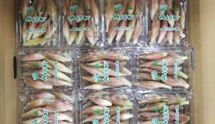
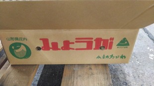
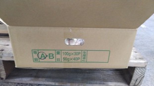
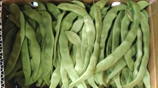
Photo_21-07-22-06-55-16.673~2.jpg

Of the garlic in Japan, most of the garlic in Towada City, which boasts a market share of about 20%, is derived from the highest quality Fukuchi White six-piece garlic. The flesh of the large ball gives a strong impression that the body is white like snow.

Photo_21-07-22-06-55-31.139-9ba9f.jpg

In Aomori Prefecture, not only the goodness of excellent seeds, but also the soil preparation suitable for garlic cultivation, advanced cultivation technology and fine management, as well as drying and storage technology, which have been inherited from our predecessors, make high quality garlic. Ships all year round. It seems that the seeds of apples will be planted from mid-September to mid-October, and the harvest time will come from late June to early July of the following year. It overwinters in a snowy field and grows slowly in the frigid cold, so it seems to have a sweet taste with less spiciness.

Photo_21-07-22-06-55-20.470-5015a.jpg

Only Value F Co., Ltd. (Akita City) sells Towada Katsuna with a label. Product name: Aomori Prefecture White Six Pieces Garlic. Not all are six pieces, but there are actually products with variations such as about 4 to 8 pieces.

Saturday, March 23, 2024

In 1800, Shudayu Minagawa received an order from Matsudaira Shinano Kami Tadaaki via Shinsuke Hara, and in 1858, Takeshiro Matsuura was ordered by the shogunate to explore and survey Tokachi. In other words, the Ainu people's heaven and earth "Ezo: 東西蝦夷山川地理取調図, 1855" will become Japanese territory by agreement using public international law between nations with national systems backed by military force. From the Land of Love to Happiness From the precincts surrounded by spring water and occasional flowers, preserving the ancient Shinto music of the Taisho Shrine. It is dedicated on June 25th and September 8th every year on the grounds of a shrine precinct.

Agriculture in Tokachi was often hit by poor harvests, which coincided with the economic downturn, and it seems that there was no shortage of people leaving farming. However, in 1914, with the outbreak of World War I and food shortages in Europe, Obihiro saw an increase in the export of legumes via Otaru Port due to the opening of the Kushiro Line (currently the Nemuro Main Line). As a result, there was a bean boom. I have heard that pioneer farmers who were previously self-sufficient are now able to engage in farming with confidence. At the same time, the scale of farming continued to expand with the shift from human power to animal power using horses, and agriculture began to see further progress.


【Product name】
Taisho make queen
【Type】
Solanum tuberosum L.
【Wholesale area】
Taisho Honcho, Obihiro City, Hokkaido (JA Obihiro-Taisho)
【Origin of name】
It seems that it was named after the queen who was chosen for the medieval spring festival (May Day: worker's festival held all over the world).
【Major features】
大正「大亨以正, 天之道也」: 大いに亨(とほ)りて以て正しきは, 天の道なり,「すべて滞りなく順調に運び正しさを得る」. Taisho Shrine (Amaterasu Okami): February 1921 Volunteers of Satsunai Village consulted, and in July 1922 the shrine was built with local resident's wealth, and the shrine was called Amaterasu Okami, and a ceremony was held under the name of Koshin Shrine. bottom. On May 1, 1926, due to the change of village boundaries, the villagers united and aspired to apply as a village shrine. On March 10, 1930, an application was made to change the name of the shrine to Taisho Shrine, and on May 17, 1930, it was approved. From the prefectural governor with a prefectural ordinance based on an imperial decree, those appointed to accept offerings of food, alcohol and gifts of monery wrapped at the prayer festival, the Niiname Festival (ceremonial offering to the deities by the Emperor of newly-harvested rice), and the annual festival A shrine dedicated to in paper called heihakuryo). The opening of the Hiroo Line in 1929 interfered with worship, so it was moved to its current location in 1934. Currently, it is revered as a guardian deity of the region, as a god of child rearing, performing arts, and good luck. Trademark Registration No. 5051632, Taisho Chinese yam, right holder: Obihiro Sei Agricultural Cooperative, Designated Goods or Designated Services, Obihiro City, Hokkaido Taishohoncho, Taisho Town, Aikoku Town, Showa Town, Kofuku Town, Sakuragi Town, Itaira Town, Izumi Town, Nakajima Town, Makubetsu Town, Nakagawa District Section of village Komai, Chinese yam produced by cooperative members who farm in the Sakae and Mikawa areas. The history of Taisho Chinese yam cultivated in the Obihiro Taisho area of Tokachi is about 40 years. Cultivation started with 3 producers, and now 76 producers are planting 200 ha. In order to deliver high-quality “Taisho Chinese Yam” to our customers, all producers work together to ensure thorough cultivation management. "Taisho Chinese Yam" is not only shipped domestically, but also exported to Taiwan and the United States. JA Obihiro Taisho is located 17 km south of the center of Obihiro City, Hokkaido, and has Obihiro Airport, the gateway to Tokachi. This is the area with the most blue skies and clear skies in Japan. The terrain is flat, and the arable land is mostly volcanic, with some alluvial soils. The Taisho region is known as "the hometown of Taisho May Queen (potatoes) and Taisho Kintoki beans.'' The main crops are wheat, sugar beets, potatoes, and beans. Yam is one of the local specialties along with potatoes and beans. It is an upland dairy farming area that includes vegetables. In this area, the production of edible potatoes (May Queen) has been thriving for a long time, and on the other hand, it was also a battle with potato common scab, the natural enemy of edible potatoes. This disease is affected by the acidity (pH) of the soil, and it is said that the higher the pH, the higher the possibility of contracting the disease. Therefore, it seems that the application of calcareous materials to neutralize the soil was less than in other regions. This situation has continued for many years, and in recent years the yield of various crops has been sluggish. As a result, about 70% of the 1,000 brushes analyzed in fiscal 1997 had a pH of less than 5.5 (very strongly acidic), and 20% of the fields had a pH of less than 5.0, which is unsuitable for growing crops. A drunken person is revealed to be in a difficult situation. In order to solve this urgent problem, our cooperative requested the cooperation of the Tokachi Chubu District Agricultural Improvement and Extension Center, Obihiro City Agricultural Promotion Public Corporation, and the Tokachi Federation of Agricultural Cooperatives to form the Taisho Soil Diagnosis Project Team formed. In the following year, as a project in 1998, we conducted soil analysis of about 900 points, and held a demonstration exhibition to confirm the effect of lime application in sugar beet fields so that producers could see and feel the local fields. It seems that they installed it in 12 fields and gave a technical improvement class in the blue sky workshop on site. In addition, it seems that they have been trying to improve farming techniques by conducting surveys on the effects of high and low pH on potatoes, wheat protein content surveys, and questionnaire surveys, and disseminating them to producers at conferences, seminars, etc. Streptomyces spp.: A disease whose occurrence is increasing with the alkalinization of soil. Light brown to grey-brown crusty lesions are formed on the surface of the tuber, which are of different sizes and slightly raised in the peripheral part and slightly depressed in the central part. The tissue under the lesion is pale brown and slightly rotten. This symptom is typical of this disease and is called common scab. Deeply sunken large deep scabs are often formed like the scars of feeding damage of molasses, and there seems to be raised scabs in which lesions swell like cushions. On the other hand, there is russet scab in which superficial lesions become network fissures. This is also known as tortoise shell disease. In other symptoms, grayish white powder (mycelia, spores) is seen in the lesions of tubers immediately after digging. It does not affect the yield, but if it occurs frequently, it seems to greatly reduce its value as food. In addition, according to NARO's verification, there are measures such as seed potato treatment, but fundamental measures such as soil disinfection are not taken except for some small farms in Honshu where the unit price of produce is relatively high. Apparently not. On the other hand, in the Kyushu region, which is centered on the remote islands of Kagoshima Prefecture, the application of rice bran has traditionally been practiced at the private level as a countermeasure against potato scab. Is scientifically unexplained. Therefore, we have scientifically verified the suppressive effect of rice bran on scab disease, and clarified the disease suppression mechanism. In 1999, the Basic Law on Food, Agriculture and Rural Areas was enacted, and a new agricultural policy started. Since the Basic Plan for Food, Agriculture and Rural Areas was enacted in 2000 under the new Basic Law, the basic plan has been reviewed every five years. In addition, since the formulation of the "Basic Plan for Redevelopment of Rural Areas in Obihiro City" in 1971, Obihiro City's plan for agricultural promotion has been the "5th Obihiro City Basic Plan for Agriculture and Rural Areas" formulated in 2010. It is formulated as a guideline for agricultural promotion in Motoichi while keeping an eye on various issues in each era. The environment surrounding agriculture is undergoing major changes, such as the declining population, the acceleration of economic globalization and technological innovation, and climate change, and is expected to become even more severe in the future. In addition to responding appropriately to changes in the environment surrounding agriculture and farming villages, the city's agriculture will continue to grow in the future, based on the government's "Basic Plan for Food, Agriculture, and Rural Areas" and the Hokkaido Government's "Hokkaido Agriculture and Rural Development Promotion Plan." For the sustainable development of rural areas, medium-to long-term. It seems that it will be formulated as a guideline to promote measures from a different perspective. The period of the plan will be 10 years from FY2020 to FY2029, and it will be reviewed as necessary based on changes in the situation surrounding agriculture and rural areas and the progress of measures. This plan was formulated in line with the 7th Obihiro City Comprehensive Plan as a field plan that indicates the direction of measures and goals for the next 10 years regarding the promotion of agriculture and forestry, based on changes in the environment surrounding agriculture and rural areas. It seems that it was in 1948, soon after JA was founded, that JA Obihiromasa began to grow May Queen in earnest. For more than 70 years since then, he has been engaged in selecting excellent seed potatoes, improving the cultivation techniques of producers, and carrying out PR activities. Today, the planted area is 1,256 ha, and it has grown into a large production area that produces about 37% of Hokkaido's May Queen Potatoes, and has received high praise from the market nationwide. Shipped 25,000 tons, harvested from August to September. Shipped from August to March. Regional collective trademark. Taisho May Queen potatoes (trademark registration No. 5051631): Reduced the amount of pesticides used since 2003. Stem and leaf chopper treatment: During the yellowing period (ripening period) of potato stems and leaves, the above-ground stems and leaves are mechanically treated to enable timely harvesting. JA Taisho Obihiro Top Brand―It operates its own fertilizer factory and supplies producers with fertilizer suitable for the region. With a feature that there is little variation in quality for half a year with great care from sowing to harvesting work. It is due to the excellent professional skills cultivated over many years by professional producers using fertilizers that are suitable for the soil. It is located almost in the center of the Tokachi region in eastern Hokkaido. It is the center of the Tokachi region(Mainly in the agricultural industry, 1 city 16 towns 2 villages)and plays a role as an agricultural product accumulation area and a commercial city. Full-scale development began in 1883. The history of systematic urban formation such as a grid-shaped road network. It is the foundation of our predecessors that we can experience both the ease of living and the richness of nature. The reason for Tokachi's core city. The self-sustaining development of local regions will depend on taking advantage of the potential of cities and, from a wider-ranging perspective, seeking forms of development whereby the merits of agglomeration spill over into peripheral areas, while also fostering key cities to form the core of regional economies. Article 67 In addition to what is prescribed in the main clause of the preceding Article, affairs which are specified as those to be determined by prefectures in this Act and are specified by a Cabinet Order shall be determined by designated cities set forth in Article 252-19, paragraph (1) of the Local Autonomy Act (Act No. 67 of 1947) (hereinafter referred to as "designated cities") or by core cities set forth in Article 252-22, paragraph (1) of the same Act (hereinafter referred to as "core cities") from designated cities or core cities (hereinafter referred to as "designated cities, etc.") pursuant to a Cabinet Order. In this case, the provisions of this Act concerning prefectures shall apply to designated cities, etc. as the provisions concerning designated cities, etc. The area of Obihiro City is 619.34 square kilometers, and the southwestern part is occupied by the Hidaka Mountains such as Mt. Tokachiporoshiri (1,846 m)(日高山脈襟裳国定公園(a national park in Hokkaido called Hidaka Sanmyaku Erimo National Park)ーIt boasts an area of about 10% of the city area.). The flat land in the center and northeast, which occupies about 60% of the city area. About half is one of the largest large-scale management in Japan: Dairy and upland farming. The city is located at the northeastern end of the city area, adjacent to the Tokachi River and Satsunai River(It has long been useful as raw tap water), which are the sixth largest basin areas in Japan. The average annual temperature is 6.8 degrees Celsius, the annual rainfall is about 888 mm, and the rainfall of 1 mm or more is about 85 days a year, which is a cool and light rain region in Japan. Since it is located inland, the daily temperature difference is relatively large. In normal years, the difference between the highest and lowest temperatures averages 10.4 degrees. In winter, the lowest temperature tends to drop even in Hokkaido. There are 156 days a year when the minimum temperature falls below freezing, and it drops to around 20 degrees below freezing during the cold season. There are many sunny days throughout the year, and the sunny weather tends to continue from autumn to winter, making it ideal for living. Fire prevention line; An oblique road that imitates the city of Washington, the capital of the United States. For preventing the spread of large-scale fires. Currently, it is used as a road and a green area and has been inherited. As a reminder, the May Queen in, which’s easy to peel off, is air-dried using a fan, etc., so that it looks beautiful. In Assho era, the town of Assabu(Hiyama county)in Hokkaido was considered the birthplace. It spread nationwide from the Kansai region in the 1955's. In my jurisdiction, I started growing May Queen about 30 years ago. Even in the southwestern part of the country, mulch cultivation, which covers the fields with a poly film to increase the soil temperature, has become popular since the mid-1940s. It’s said to be "the apple of the earth" because of its high nutritional value.(Excellent varieties of Hokkaido, 1972(1928-Limited recommended variety), Early Victoria, Finna Early, Finney's Victory,Glenearn, Koksiaan, Maikoenigin, Thea Kartoffel), A disease called E. Sadler grows in Bentham, which is near Cheltenham in the UK. It was introduced by the Sutton Company in 1900 to the world, and the parents are unknown. Medium initial growth and early hypertrophy. In the withered period, it’s a middle to early life or middle age, which's later than "Baron potato". It's oblong and the base's slightly bulged and slightly bent. The skin color’s white to light yellow brown. It's slightly yellowish, slightly sticky and has a pleasant texture, and has more sugar than other edible varieties immediately after harvest. When stored at low temperature, sweetness and viscosity tend to increase particularly. The smile of my family comes to my mind. Your company supports local industry as a sales and collection point for agricultural products and pesticides. Returning to the story, we must not forget "Obihiro no Mori" as a healing space. Arranged so as to surround the city from the west to the south of the city. Law on Improvement and Vitalization in City Center (entered effect in 1998),Is it a digression? It is about 11 kilometers long, about 550 meters wide, and occupies an area of 406.5 hectares. It seems that the city will be surrounded by a green belt by connecting to the Tokachi River and the Satsunai River riparian forest in a 100-year plan for the future. Based on the crop rotation system, wheat, sugar beet, beans, and potato are the basics against the background of blessed land conditions.


May Queen potatoes were introduced to Japan around 1917-1918. I heard that the Obihiro General Agricultural Cooperative began full-scale cultivation of May Queen around 1948, soon after the establishment of the cooperative. At first, it was weak against disease, and the yield was low compared to other potatoes. The excellent agricultural products grown in the Taisho area, where there is a large temperature difference between day and night, are full of sweetness. The feature is that the buds are not deep and easy to process.


Stem and leaf chopper processing is the mechanical processing of stems and leaves on the ground during the yellowing period (maturity) of potato stems and leaves, making it possible to harvest at a more appropriate time.


Made in England, May Queen potatoes have a strong sweetness and low starch content, so they do not fall apart when cooked. Dnforced (Law No. 51 aims to quarantine imported and imported plants and domestic plants, exterminate plants and animals that are harmful to plants, and prevent their spread, thereby ensuring the safety and promotion of agricultural production. Import and domestic quarantine to prevent the invasion and spread of pests that do not exist in Japan or exist in some parts of the country, domestic control to control pests that exist in Japan, requirements of export destination countries and regions At the same time, cultivation techniques were improved with the support of farm engineers and district associations, and selected seeds were produced. Having gained insight into the edible characteristics of this plant, it seems that they have established a seed production system and actively started management guidance because they had high hopes for the near future.